MyTopo
Richmond Oregon US Topo Map
Couldn't load pickup availability
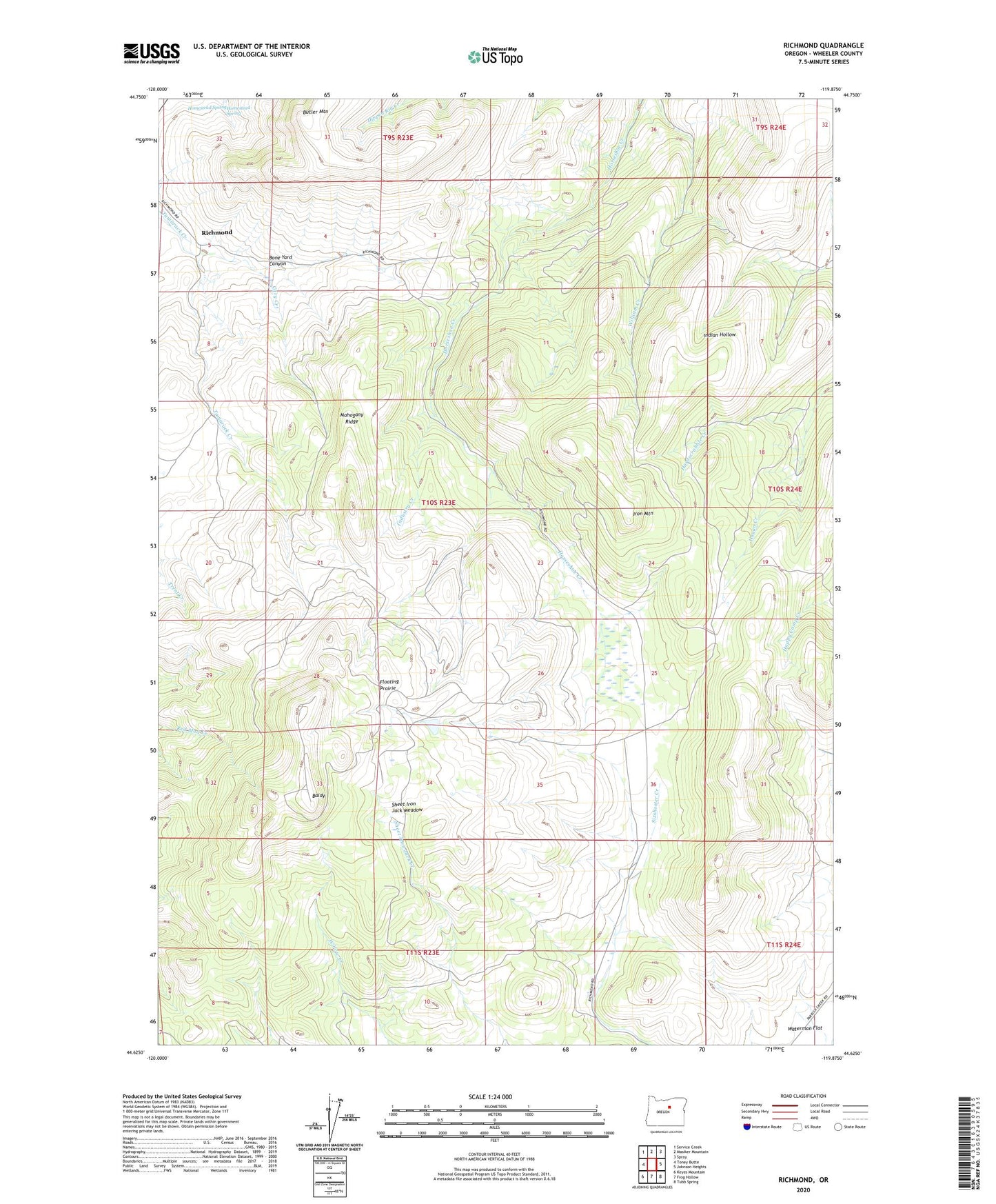
2023 topographic map quadrangle Richmond in the state of Oregon. Scale: 1:24000. Based on the newly updated USGS 7.5' US Topo map series, this map is in the following counties: Wheeler. The map contains contour data, water features, and other items you are used to seeing on USGS maps, but also has updated roads and other features. This is the next generation of topographic maps. Printed on high-quality waterproof paper with UV fade-resistant inks.
Quads adjacent to this one:
West: Toney Butte
Northwest: Service Creek
North: Masiker Mountain
Northeast: Spray
East: Johnson Heights
Southeast: Tubb Spring
South: Frog Hollow
Southwest: Keyes Mountain
This map covers the same area as the classic USGS quad with code o44119f8.
Contains the following named places: Baldy, Bone Yard Canyon, Butler Mountain, Cary Creek, Floating Prairie, Hogan Creek, Homestead Spring, Industry Creek, Iron Mountain, Mahogany Ridge, Mitchell Division, Richmond, Richmond Post Office, Sheet Iron Jack Meadow, Sixshooter Ranch