MyTopo
Sheep Ridge Oregon US Topo Map
Couldn't load pickup availability
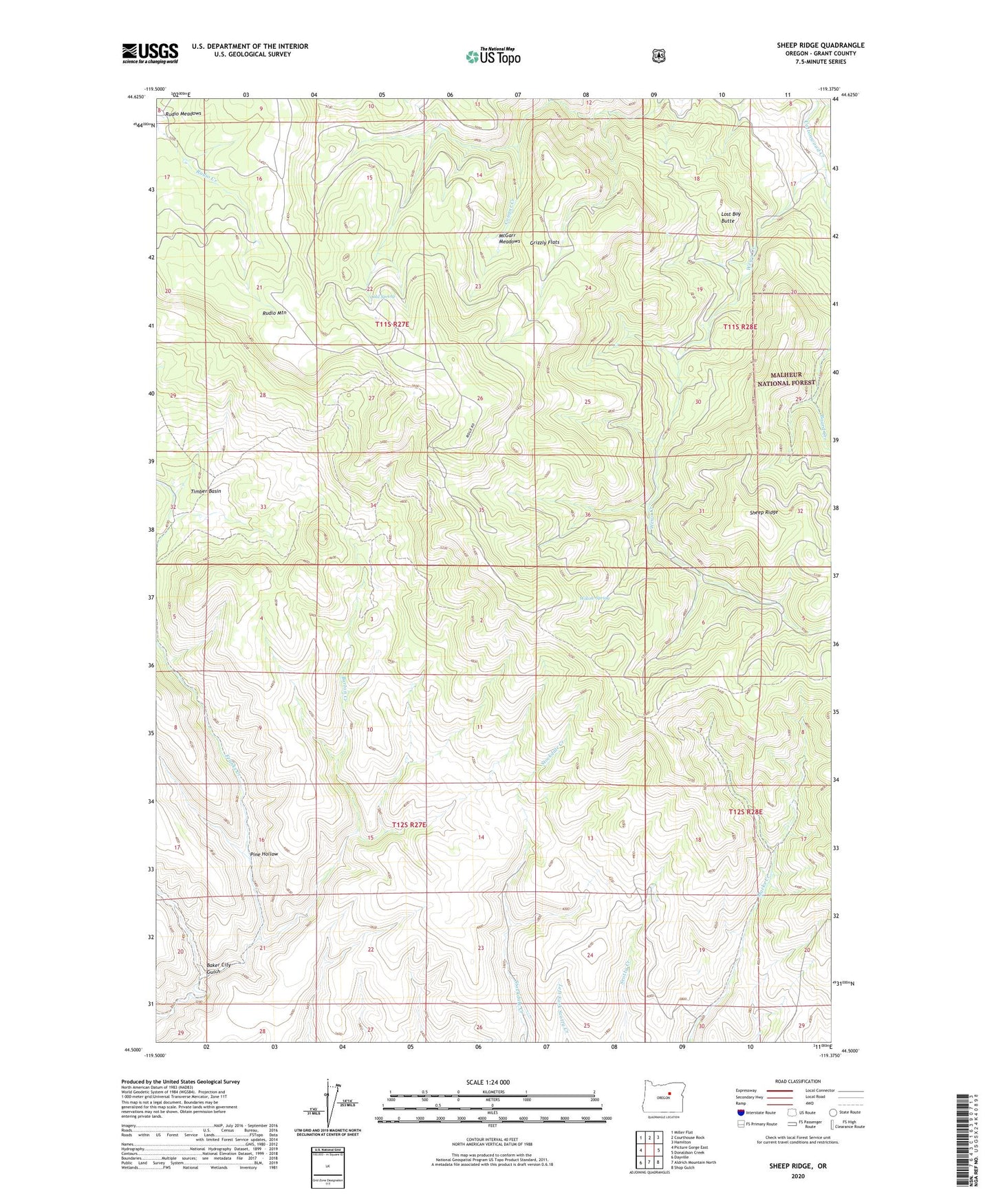
2020 topographic map quadrangle Sheep Ridge in the state of Oregon. Scale: 1:24000. Based on the newly updated USGS 7.5' US Topo map series, this map is in the following counties: Grant. The map contains contour data, water features, and other items you are used to seeing on USGS maps, but also has updated roads and other features. This is the next generation of topographic maps. Printed on high-quality waterproof paper with UV fade-resistant inks.
Quads adjacent to this one:
West: Picture Gorge East
Northwest: Miller Flat
North: Courthouse Rock
Northeast: Hamilton
East: Donaldson Creek
Southeast: Shop Gulch
South: Aldrich Mountain North
Southwest: Dayville
Contains the following named places: Baker City Gulch, Board Creek, Burton Creek, Cold Spring, Grizzly Flats, Lost Boy Butte, McGarr Meadows, Pine Hollow, Rudio Meadows, Rudio Mountain, Rudio Mountain Lookout, Sheep Ridge, Timber Basin, Wewa Creek, Willow Spring