MyTopo
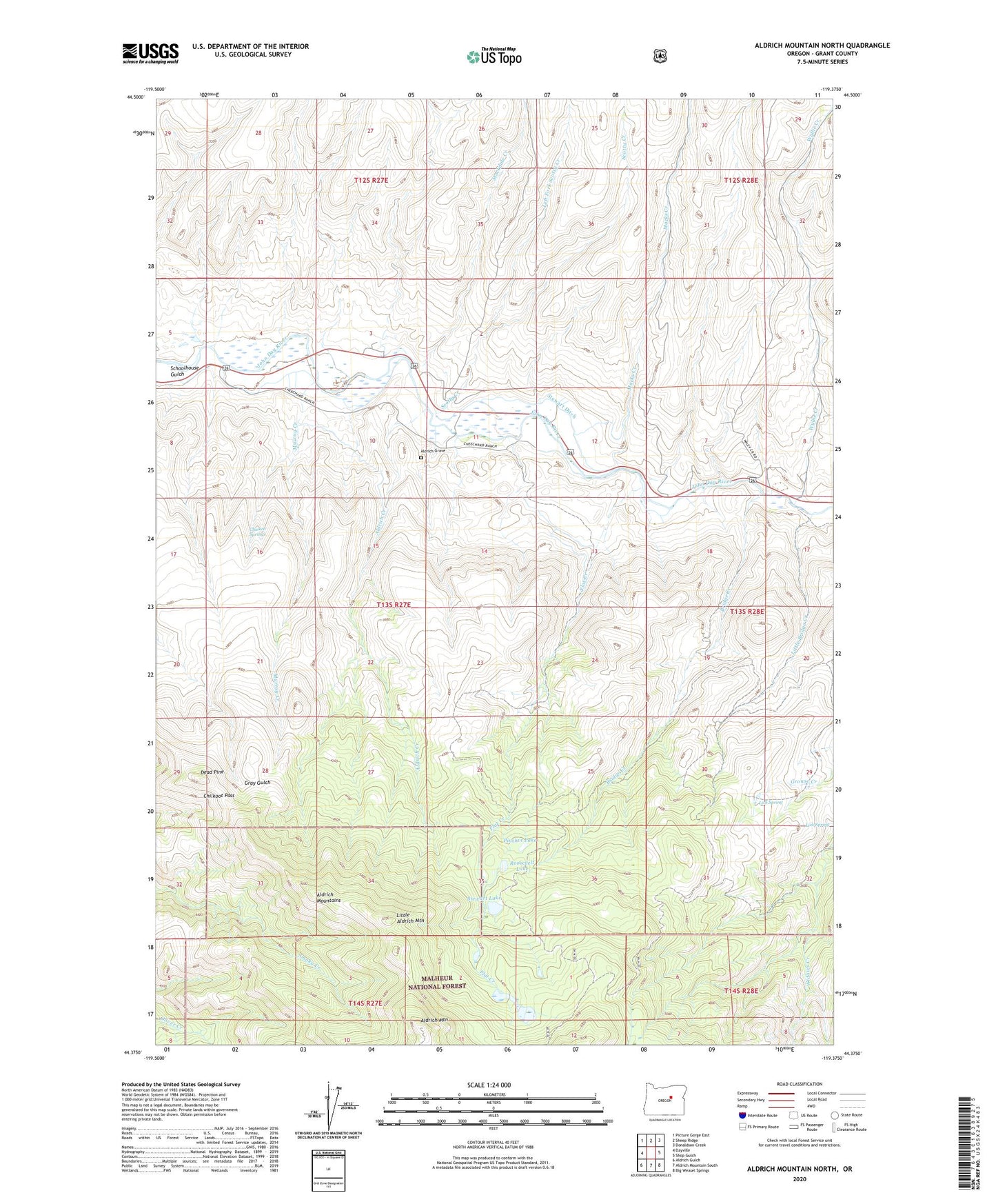
Aldrich Mountain North Oregon US Topo Map
Couldn't load pickup availability
Also explore the Aldrich Mountain North Forest Service Topo of this same quad for updated USFS data
2023 topographic map quadrangle Aldrich Mountain North in the state of Oregon. Scale: 1:24000. Based on the newly updated USGS 7.5' US Topo map series, this map is in the following counties: Grant. The map contains contour data, water features, and other items you are used to seeing on USGS maps, but also has updated roads and other features. This is the next generation of topographic maps. Printed on high-quality waterproof paper with UV fade-resistant inks.
Quads adjacent to this one:
West: Dayville
Northwest: Picture Gorge East
North: Sheep Ridge
Northeast: Donaldson Creek
East: Shop Gulch
Southeast: Big Weasel Springs
South: Aldrich Mountain South
Southwest: Aldrich Gulch
This map covers the same area as the classic USGS quad with code o44119d4.
Contains the following named places: Aldrich Creek, Aldrich Grave, Aldrich Mountain, Bridge Creek, Chicken Springs, Chilkoot Pass, Dead Pine, Flat Creek, Left Fork Scotty Creek, Lick Spring, Little Aldrich Mountain, Little Bridge Creek, Marks Creek, Murray Creek, Pinchot Lake, Roosevelt Lake, Schoolhouse Gulch, Scotty Creek, Stewart Ditch, Stewart Lake, Stewarts Crossing, Stockdale Creek, Wyllie Creek, ZIP Code: 97825