MyTopo
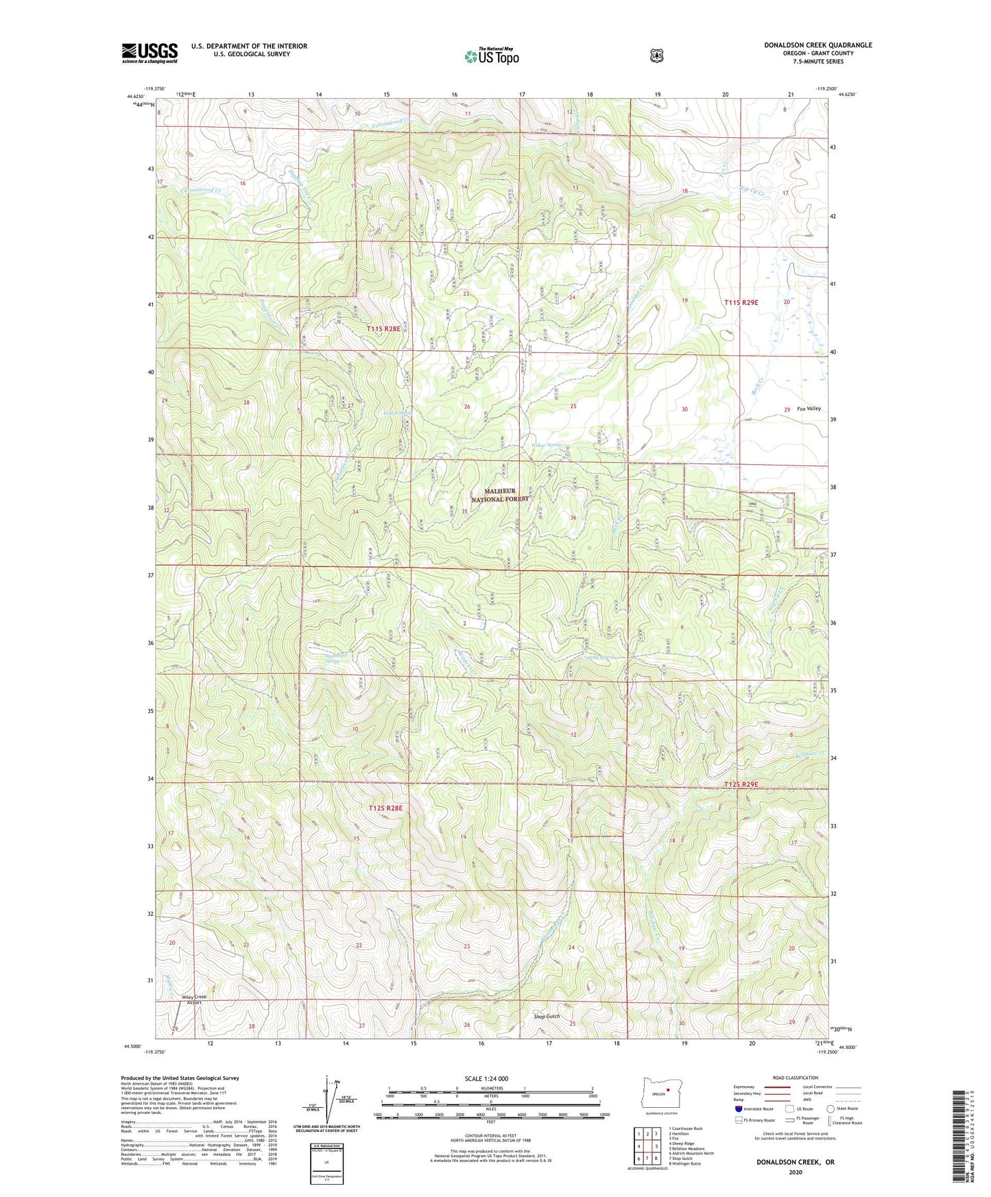
Donaldson Creek Oregon US Topo Map
Couldn't load pickup availability
Also explore the Donaldson Creek Forest Service Topo of this same quad for updated USFS data
2023 topographic map quadrangle Donaldson Creek in the state of Oregon. Scale: 1:24000. Based on the newly updated USGS 7.5' US Topo map series, this map is in the following counties: Grant. The map contains contour data, water features, and other items you are used to seeing on USGS maps, but also has updated roads and other features. This is the next generation of topographic maps. Printed on high-quality waterproof paper with UV fade-resistant inks.
Quads adjacent to this one:
West: Sheep Ridge
Northwest: Courthouse Rock
North: Hamilton
Northeast: Fox
East: Belshaw Meadows
Southeast: Wolfinger Butte
South: Shop Gulch
Southwest: Aldrich Mountain North
This map covers the same area as the classic USGS quad with code o44119e3.
Contains the following named places: Beck Creek, Boag Creek, Boulder Creek, Camp Creek, Dipping Vat Creek, Dolly Spring, Donaldson Creek, Fox Creek, Hinton Spring, Pismire Camp, Sagebrush Spring, Sand Creek, Slip Up Creek, Wildcat Creek, Wiley Creek Airport, Willow Spring