MyTopo
Shoestring Ridge Oregon US Topo Map
Couldn't load pickup availability
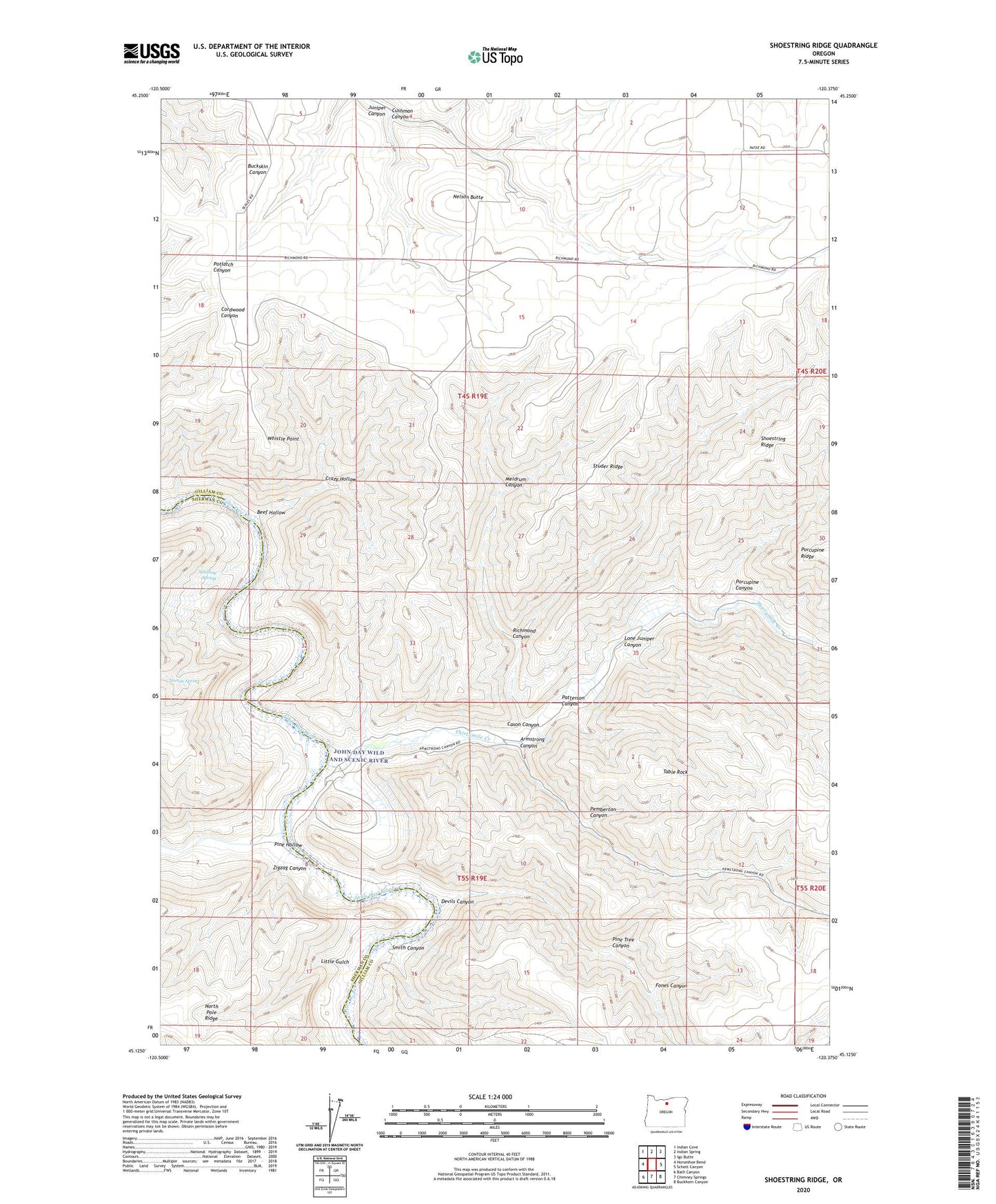
2020 topographic map quadrangle Shoestring Ridge in the state of Oregon. Scale: 1:24000. Based on the newly updated USGS 7.5' US Topo map series, this map is in the following counties: Gilliam, Sherman. The map contains contour data, water features, and other items you are used to seeing on USGS maps, but also has updated roads and other features. This is the next generation of topographic maps. Printed on high-quality waterproof paper with UV fade-resistant inks.
Quads adjacent to this one:
West: Horseshoe Bend
Northwest: Indian Cove
North: Indian Spring
Northeast: Igo Butte
East: Schott Canyon
Southeast: Buckhorn Canyon
South: Chimney Springs
Southwest: Bath Canyon
Contains the following named places: Armstrong Canyon, Beef Hollow, Cason Canyon, Crazy Hollow, Cushman Canyon, Devils Canyon, Fones Canyon, John Day Wild and Scenic River, Little Gulch, Lone Juniper Canyon, Meldrum Canyon, Nelson Butte, Patterson Canyon, Pemberton Canyon, Pine Hollow, Pine Tree Canyon, Porcupine Canyon, Rattray Ranch, Richmond Canyon, Schilling Spring, Shoestring Ridge, Smith Canyon, Studer Ridge, Table Rock, Thirtymile Creek, Whistle Point, Zigzag Canyon