MyTopo
Silver Dollar Flat Oregon US Topo Map
Couldn't load pickup availability
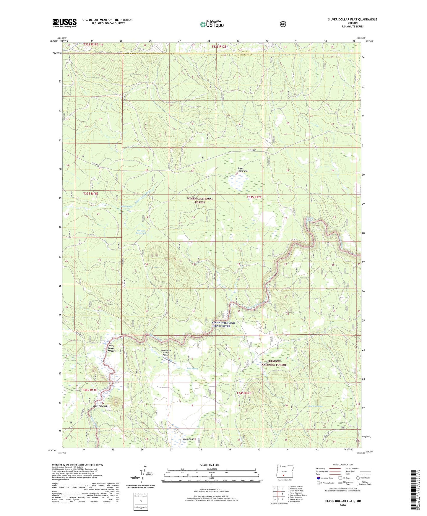
2020 topographic map quadrangle Silver Dollar Flat in the state of Oregon. Scale: 1:24000. Based on the newly updated USGS 7.5' US Topo map series, this map is in the following counties: Klamath, Lake. The map contains contour data, water features, and other items you are used to seeing on USGS maps, but also has updated roads and other features. This is the next generation of topographic maps. Printed on high-quality waterproof paper with UV fade-resistant inks.
Quads adjacent to this one:
West: Fuego Mountain
Northwest: The Bull Pasture
North: Hamelton Butte
Northeast: Sycan Marsh West
East: Riverbed Butte Spring
Southeast: Ponina Butte
South: Spodue Mountain
Southwest: Cooks Mountain
Contains the following named places: Bottle Spring, Cordelia Flat, Godowa Spring, Moondance Ranch Airport, Pelican Bay Camp, Pelican Reservoir, Rock Spring, Silver Dollar Cinder Pit, Silver Dollar Flat, Sycan Ford, Teddy Powers Meadow, Torrent Spring