MyTopo
Riverbed Butte Spring Oregon US Topo Map
Couldn't load pickup availability
Also explore the Riverbed Butte Spring Forest Service Topo of this same quad for updated USFS data
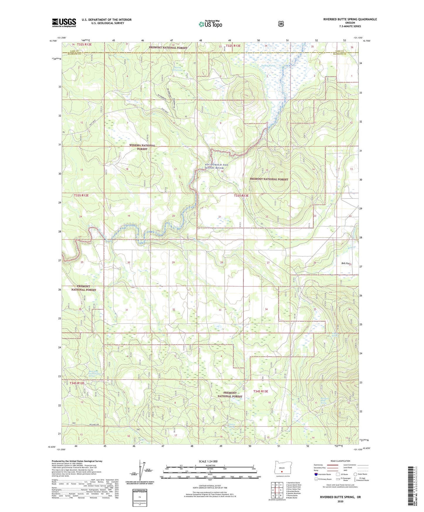
2024 topographic map quadrangle Riverbed Butte Spring in the state of Oregon. Scale: 1:24000. Based on the newly updated USGS 7.5' US Topo map series, this map is in the following counties: Klamath, Lake. The map contains contour data, water features, and other items you are used to seeing on USGS maps, but also has updated roads and other features. This is the next generation of topographic maps. Printed on high-quality waterproof paper with UV fade-resistant inks.
Quads adjacent to this one:
West: Silver Dollar Flat
Northwest: Hamelton Butte
North: Sycan Marsh West
Northeast: Sycan Marsh East
East: Riverbed Butte
Southeast: Rodeo Butte
South: Ponina Butte
Southwest: Spodue Mountain
This map covers the same area as the classic USGS quad with code o42121f2.
Contains the following named places: Black Hills Guard Station, Black Hills Guard Station Spring, Bob Creek, Bob Flat, Echo Pit Tank, Evans Pit Tank, Marsh Reservoir, Merritt Creek, Merritt Reservoir, Old Pelican Bay Camp, Riverbed Butte Spring, Sycan Fire Guard Station, Thicket Spring, Watkins Spring