MyTopo
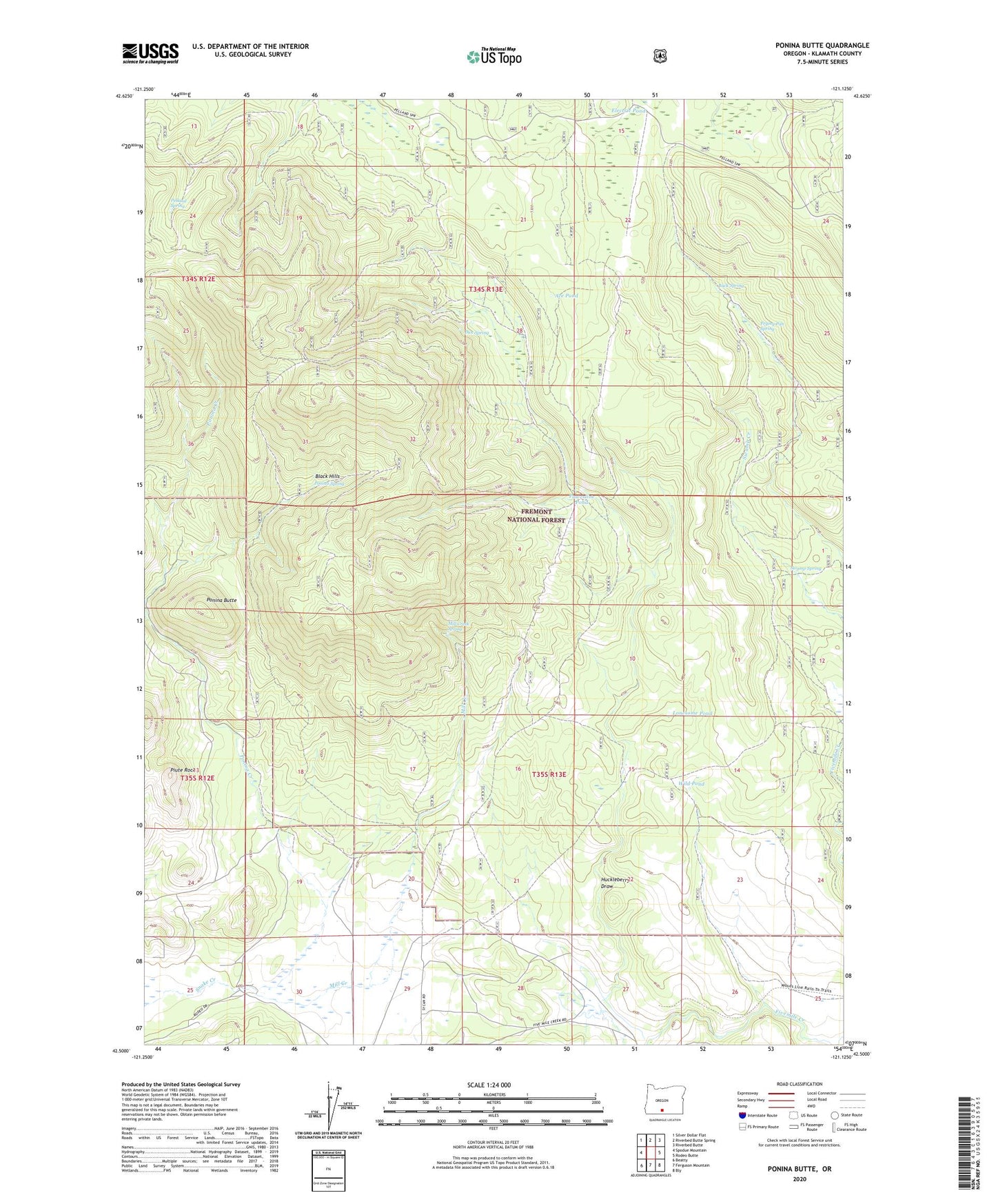
Ponina Butte Oregon US Topo Map
Couldn't load pickup availability
Also explore the Ponina Butte Forest Service Topo of this same quad for updated USFS data
2023 topographic map quadrangle Ponina Butte in the state of Oregon. Scale: 1:24000. Based on the newly updated USGS 7.5' US Topo map series, this map is in the following counties: Klamath. The map contains contour data, water features, and other items you are used to seeing on USGS maps, but also has updated roads and other features. This is the next generation of topographic maps. Printed on high-quality waterproof paper with UV fade-resistant inks.
Quads adjacent to this one:
West: Spodue Mountain
Northwest: Silver Dollar Flat
North: Riverbed Butte Spring
Northeast: Riverbed Butte
East: Rodeo Butte
Southeast: Bly
South: Ferguson Mountain
Southwest: Beatty
This map covers the same area as the classic USGS quad with code o42121e2.
Contains the following named places: Ace Pond, Buck Spring, Dice Spring, Electric Pond, Frying Pan Spring, Huckleberry Draw, Lonesome Pond, Mill Creek, Mill Creek Spring, Pelland Spring, Piute Rock, Ponina Butte, Ponina Creek, Ponina Spring, Powerline Pond, Swamp Spring, Wild Pond