MyTopo
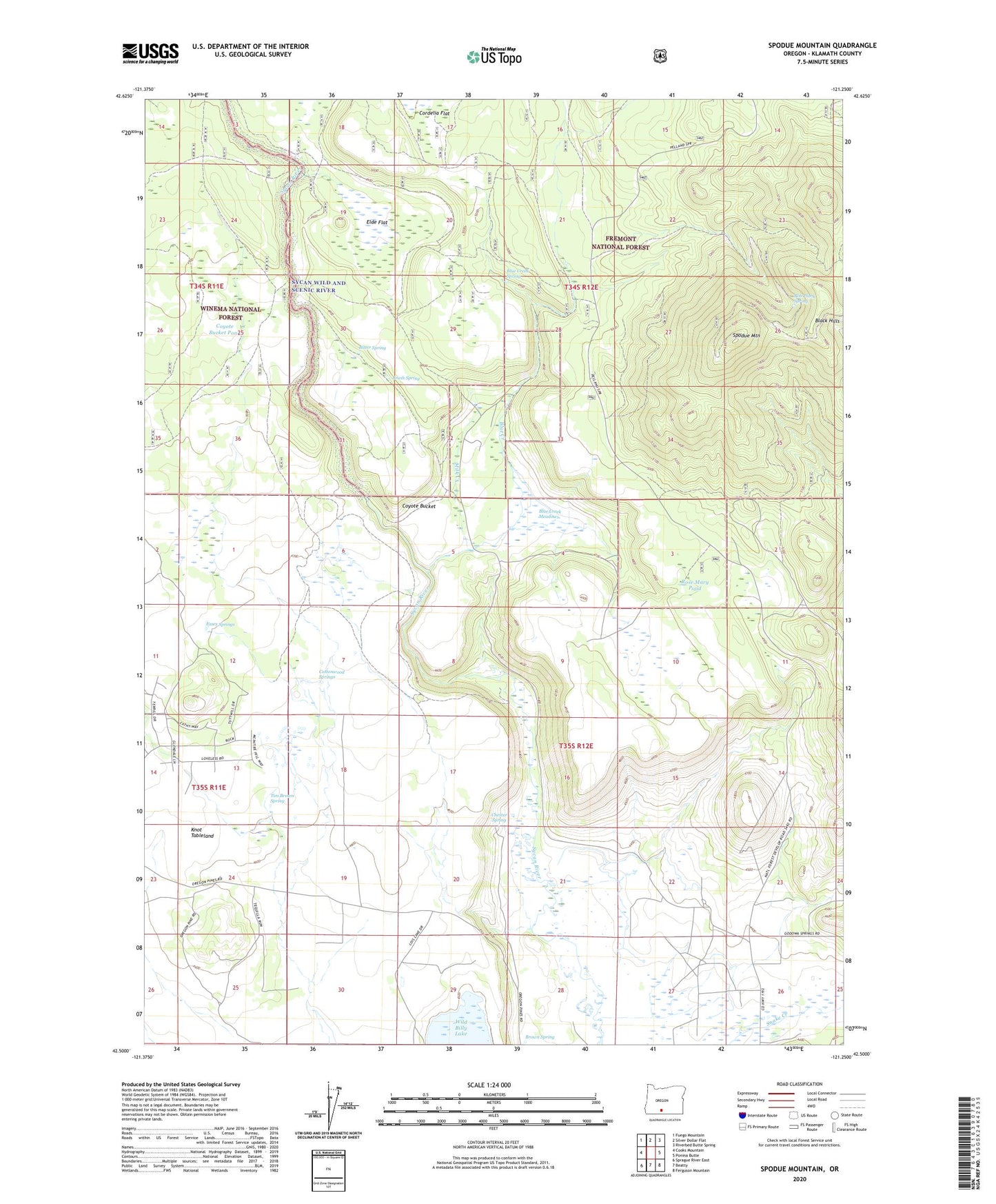
Spodue Mountain Oregon US Topo Map
Couldn't load pickup availability
Also explore the Spodue Mountain Forest Service Topo of this same quad for updated USFS data
2023 topographic map quadrangle Spodue Mountain in the state of Oregon. Scale: 1:24000. Based on the newly updated USGS 7.5' US Topo map series, this map is in the following counties: Klamath. The map contains contour data, water features, and other items you are used to seeing on USGS maps, but also has updated roads and other features. This is the next generation of topographic maps. Printed on high-quality waterproof paper with UV fade-resistant inks.
Quads adjacent to this one:
West: Cooks Mountain
Northwest: Fuego Mountain
North: Silver Dollar Flat
Northeast: Riverbed Butte Spring
East: Ponina Butte
Southeast: Ferguson Mountain
South: Beatty
Southwest: Sprague River East
This map covers the same area as the classic USGS quad with code o42121e3.
Contains the following named places: Bitter Spring, Black Hills, Black Hills Lookout, Blue Creek, Blue Creek Meadows, Blue Creek Spring, Bob Plank Spring, Brown Spring, Brush Spring, Chester Spring, Cottonwood Springs, Coyote Bucket, Coyote Bucket Pond, Elde Flat, Essex Springs, Milk Creek, Rose Mary Pond, Spodue Mountain, Tim Brown Spring, Wild Billy Lake