MyTopo
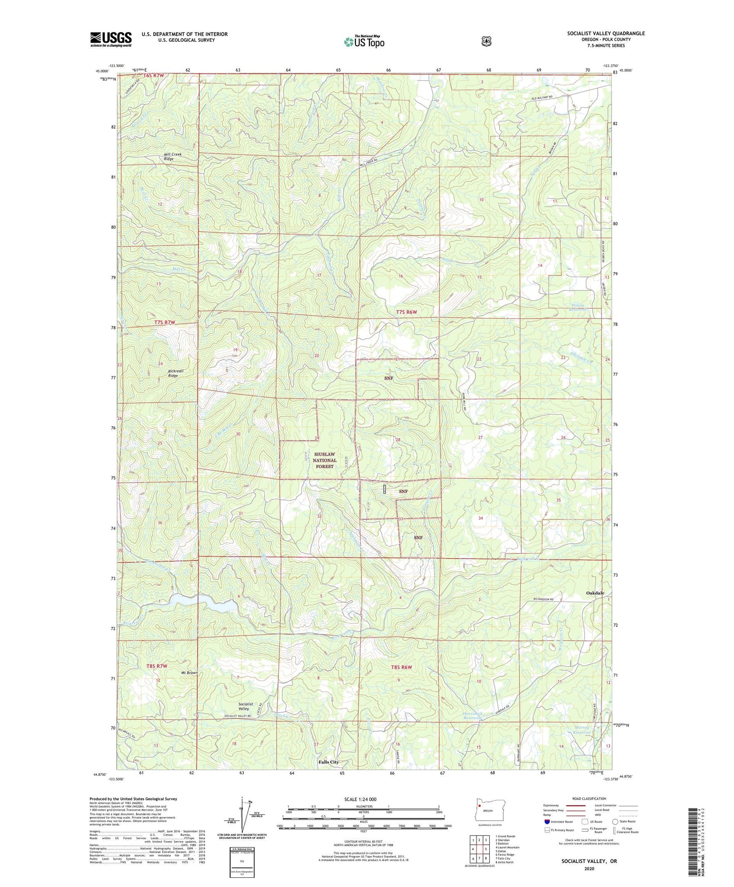
Socialist Valley Oregon US Topo Map
Couldn't load pickup availability
Also explore the Socialist Valley Forest Service Topo of this same quad for updated USFS data
2023 topographic map quadrangle Socialist Valley in the state of Oregon. Scale: 1:24000. Based on the newly updated USGS 7.5' US Topo map series, this map is in the following counties: Polk. The map contains contour data, water features, and other items you are used to seeing on USGS maps, but also has updated roads and other features. This is the next generation of topographic maps. Printed on high-quality waterproof paper with UV fade-resistant inks.
Quads adjacent to this one:
West: Laurel Mountain
Northwest: Grand Ronde
North: Sheridan
Northeast: Ballston
East: Dallas
Southeast: Airlie North
South: Falls City
Southwest: Fanno Ridge
This map covers the same area as the classic USGS quad with code o44123h4.
Contains the following named places: Aaron Mercer Reservoir, Applegate Creek, Bear Creek, Canyon Creek, George T Gerlinger State Experimental Forest, Harvstack Reservoir, Mercer Dam, Mill Creek County Park, Mill Creek Recreation Site, Mount Brown, Murray Reservoir, Oakdale, Oakdale School, Old German Brethren Church, Panther Creek, Polk County, Rockhouse Creek, Skid Creek, Socialist Valley, South Branch Mill Creek, Tillotson Creek, Wilson Reservoir