MyTopo
Airlie North Oregon US Topo Map
Couldn't load pickup availability
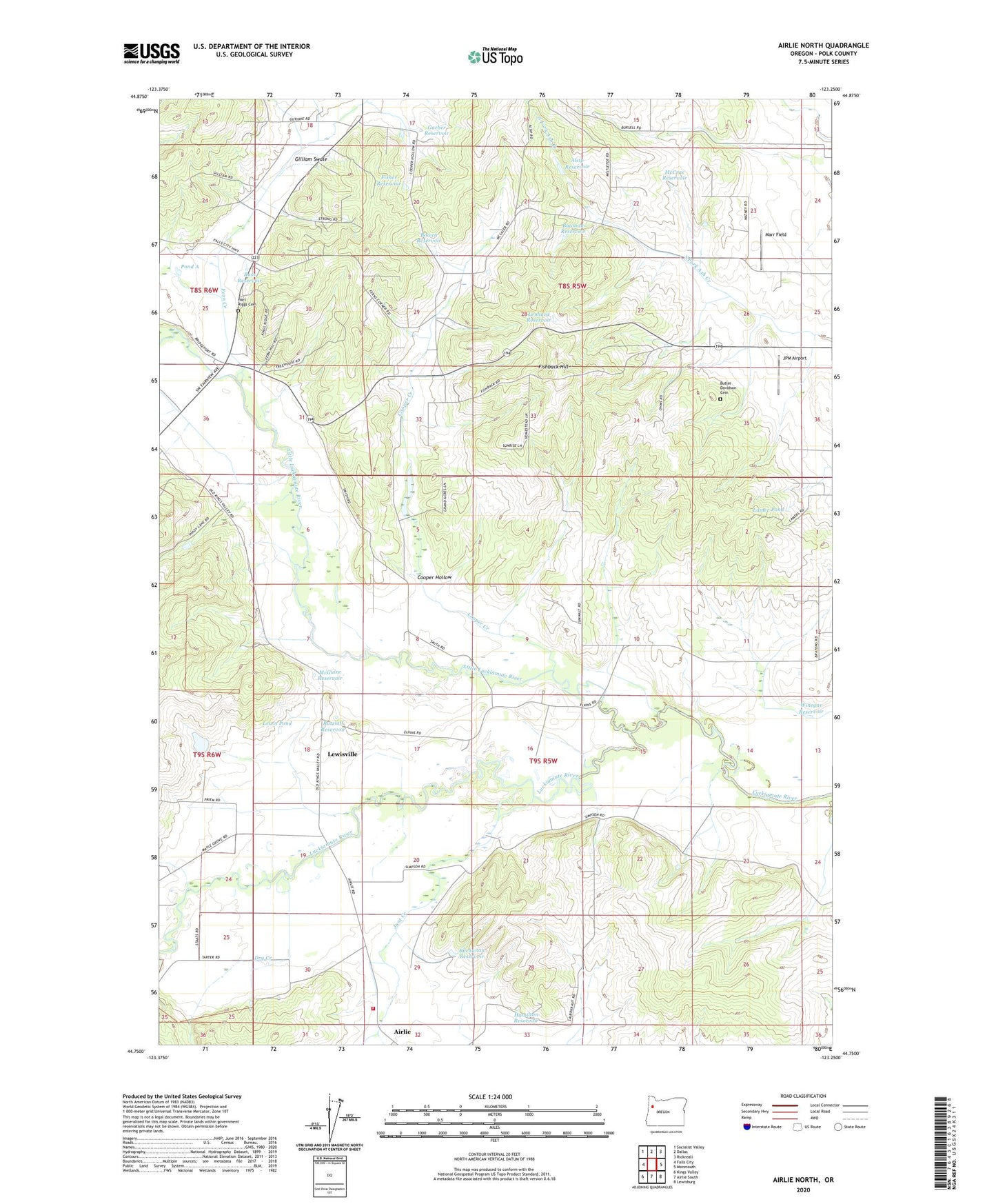
2023 topographic map quadrangle Airlie North in the state of Oregon. Scale: 1:24000. Based on the newly updated USGS 7.5' US Topo map series, this map is in the following counties: Polk. The map contains contour data, water features, and other items you are used to seeing on USGS maps, but also has updated roads and other features. This is the next generation of topographic maps. Printed on high-quality waterproof paper with UV fade-resistant inks.
Quads adjacent to this one:
West: Falls City
Northwest: Socialist Valley
North: Dallas
Northeast: Rickreall
East: Monmouth
Southeast: Lewisburg
South: Airlie South
Southwest: Kings Valley
This map covers the same area as the classic USGS quad with code o44123g3.
Contains the following named places: Airlie, Airlie Creek, Airlie Post Office, Alsip Reservoir, Bass Reservoir, Bauman Reservoir, Bowen Reservoir, Bridgeport Post Office, Buchanan Reservoir, Butler Davidson Cemetery, Cooper Creek, Cooper Hollow, Crisp, Dry Creek, Fern Corner, Fern Creek, Ferns, Fishback Hill, Fisher Reservoir, Garber Reservoir, Gilliam Swale, Gilliams, Guthrie Community Park, Hamilton Reservoir, Hart Riggs Cemetery, Jont Creek, JPM Airport, Lackemute Post Office, Lamer Pond, Lenhard Reservoir, Lewis Pond, Lewisville, Lewisville Post Office, Little Luckiamute River, Luckiamute, Maple Grove, Maple Grove Post Office, Marr Field, McCrae Reservoir, McGuire Reservoir, Mitchell, Oberg Reservoir, Polk County Fire District 1 Station 80, Polk Post Office, Pond A, Putnam, Ratzlaff Reservoir, Simpson, Tarter, V and S Crossing, Wallinch, Winegar Reservoir, ZIP Code: 97361