MyTopo
Soloman Butte Oregon US Topo Map
Couldn't load pickup availability
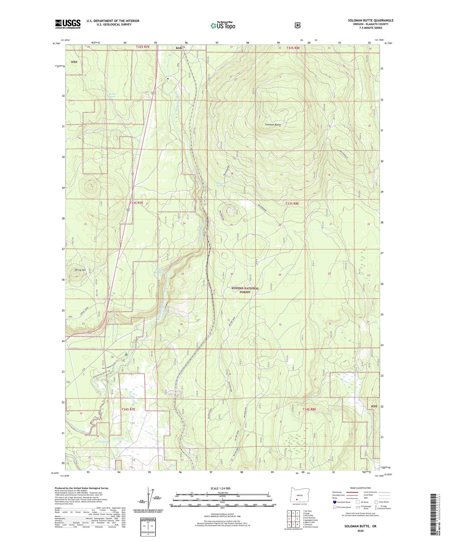
2020 topographic map quadrangle Soloman Butte in the state of Oregon. Scale: 1:24000. Based on the newly updated USGS 7.5' US Topo map series, this map is in the following counties: Klamath. The map contains contour data, water features, and other items you are used to seeing on USGS maps, but also has updated roads and other features. This is the next generation of topographic maps. Printed on high-quality waterproof paper with UV fade-resistant inks.
Quads adjacent to this one:
West: Fort Klamath
Northwest: Sun Pass
North: Fuego
Northeast: Wocus Bay
East: Applegate Butte
South: Chiloquin
Southwest: Agency Lake
Contains the following named places: Buckeroo Spring, Calimus, Hilltop Reservoir, Kirk, Kirk Post Office, Larkin Creek, Larkin Spring, Lumberton, Martin, Merritt Spring, Oux-Kanee Overlook, Oux-Kanee Recreation Site, Soloman Butte, Spring Hill, Sun Pass State Forest, Warco, Williamson River Access Park