MyTopo
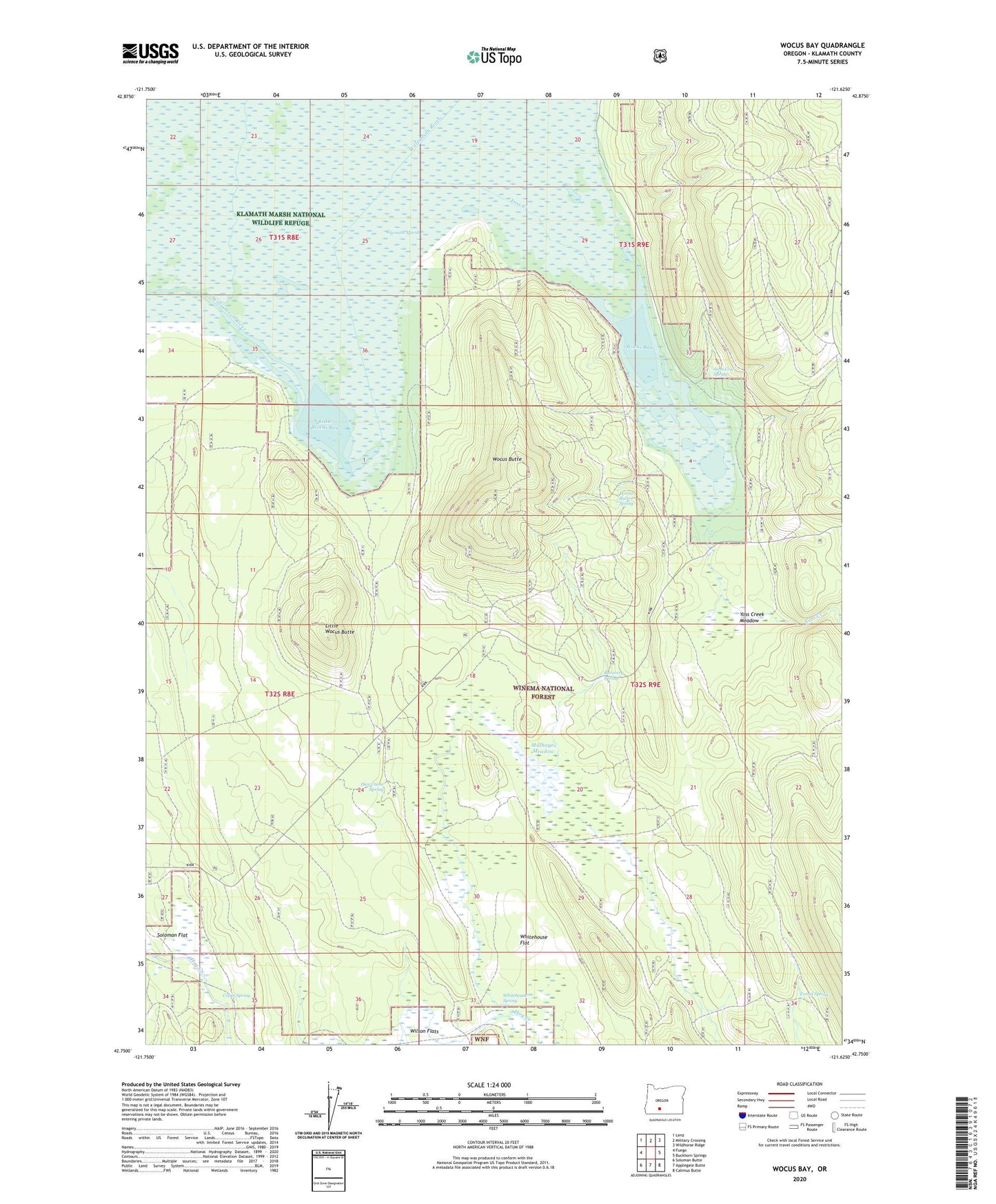
Wocus Bay Oregon US Topo Map
Couldn't load pickup availability
Also explore the Wocus Bay Forest Service Topo of this same quad for updated USFS data
2023 topographic map quadrangle Wocus Bay in the state of Oregon. Scale: 1:24000. Based on the newly updated USGS 7.5' US Topo map series, this map is in the following counties: Klamath. The map contains contour data, water features, and other items you are used to seeing on USGS maps, but also has updated roads and other features. This is the next generation of topographic maps. Printed on high-quality waterproof paper with UV fade-resistant inks.
Quads adjacent to this one:
West: Fuego
Northwest: Lenz
North: Military Crossing
Northeast: Wildhorse Ridge
East: Buckhorn Springs
Southeast: Calimus Butte
South: Applegate Butte
Southwest: Soloman Butte
This map covers the same area as the classic USGS quad with code o42121g6.
Contains the following named places: Cabin Spring, Dice Crane Spring, Forest Spring, John Cole Spring, Little Wocus Bay, Little Wocus Butte, Lucky Reservoir, Millhayes Meadow, Old Forest Camp, Recovery Spring, Whitehouse Flat, Whitehouse Spring, Winema National Forest, Wocus Bay, Wocus Bay Guard Station, Wocus Butte, Wocus Butte Spring, Yoss Creek, Yoss Creek Meadow