MyTopo
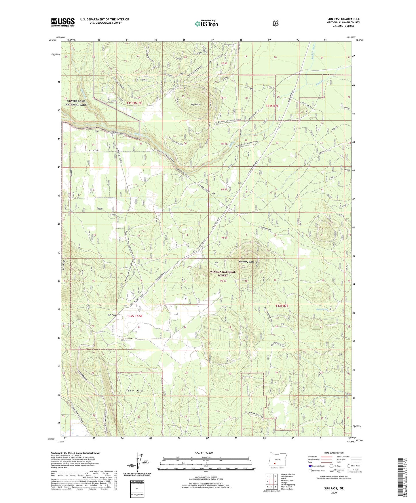
Sun Pass Oregon US Topo Map
Couldn't load pickup availability
Also explore the Sun Pass Forest Service Topo of this same quad for updated USFS data
2023 topographic map quadrangle Sun Pass in the state of Oregon. Scale: 1:24000. Based on the newly updated USGS 7.5' US Topo map series, this map is in the following counties: Klamath. The map contains contour data, water features, and other items you are used to seeing on USGS maps, but also has updated roads and other features. This is the next generation of topographic maps. Printed on high-quality waterproof paper with UV fade-resistant inks.
Quads adjacent to this one:
West: Maklaks Crater
Northwest: Crater Lake East
North: Pothole Butte
Northeast: Lenz
East: Fuego
Southeast: Soloman Butte
South: Fort Klamath
Southwest: Mares Egg Spring
This map covers the same area as the classic USGS quad with code o42121g8.
Contains the following named places: Boundary Butte, Cavern Creek, Dry Butte, Egan Springs, Pinnacle Valley, Sand Creek Canal, Sand Creek Junction, Sun Mountain, Sun Pass, Wheeler Creek