MyTopo
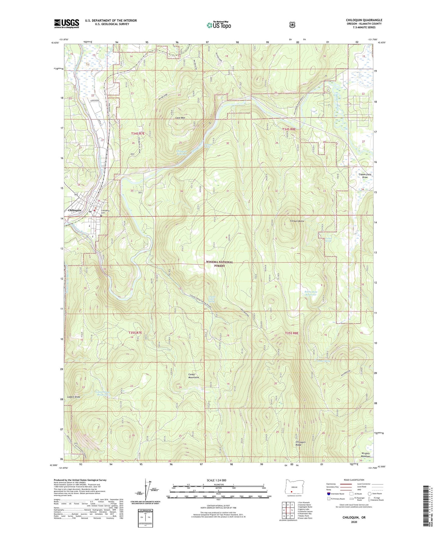
Chiloquin Oregon US Topo Map
Couldn't load pickup availability
Also explore the Chiloquin Forest Service Topo of this same quad for updated USFS data
2023 topographic map quadrangle Chiloquin in the state of Oregon. Scale: 1:24000. Based on the newly updated USGS 7.5' US Topo map series, this map is in the following counties: Klamath. The map contains contour data, water features, and other items you are used to seeing on USGS maps, but also has updated roads and other features. This is the next generation of topographic maps. Printed on high-quality waterproof paper with UV fade-resistant inks.
Quads adjacent to this one:
West: Agency Lake
Northwest: Fort Klamath
North: Soloman Butte
Northeast: Applegate Butte
Southeast: Swan Lake Point
South: Modoc Point
Southwest: Shoalwater Bay
This map covers the same area as the classic USGS quad with code o42121e7.
Contains the following named places: Bray Mill, Braymill, Braymill Cinder Pit, Braymill Post Office, Cave Mountain, Chiloquin, Chiloquin Agency Lake Fire District Station 1, Chiloquin City Hall, Chiloquin Elementary School, Chiloquin High School, Chiloquin Narrows, Chiloquin Post Office, Chiloquin Public Works Department Office, Chiloquin Rapids, Chiloquin Ridge, Chiloquin Sewage Treatment Facility, City of Chiloquin, Corbell Butte, Corbell Cinder Pit, Corbell Spring, Crystal Castle Spring, Friendship Cemetery, Grouse Spring, Klamath County Dump, Klamath County Library Chiloquin Branch, Lobert Draw Reservoir, Pine Ridge, Pine Ridge Post Office, Rafter Ranch, Ritter, Rocky Hole Reservoir, Special Trust Land, Sprague River, Sycan