MyTopo
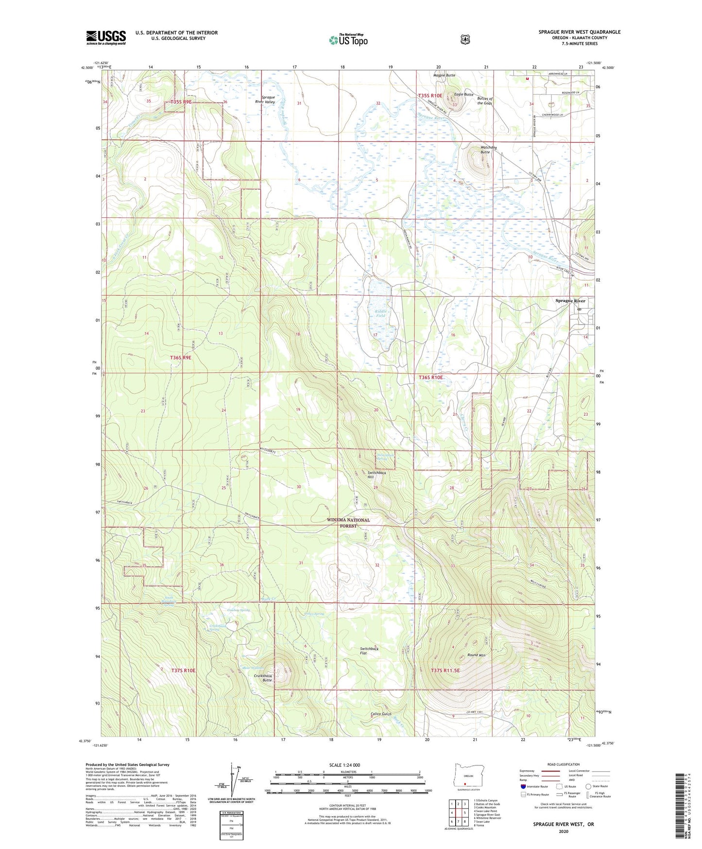
Sprague River West Oregon US Topo Map
Couldn't load pickup availability
Also explore the Sprague River West Forest Service Topo of this same quad for updated USFS data
2023 topographic map quadrangle Sprague River West in the state of Oregon. Scale: 1:24000. Based on the newly updated USGS 7.5' US Topo map series, this map is in the following counties: Klamath. The map contains contour data, water features, and other items you are used to seeing on USGS maps, but also has updated roads and other features. This is the next generation of topographic maps. Printed on high-quality waterproof paper with UV fade-resistant inks.
Quads adjacent to this one:
West: Swan Lake Point
North: Buttes of the Gods
Northeast: Cooks Mountain
East: Sprague River East
Southeast: Yonna
South: Swan Lake
Southwest: Whiteline Reservoir
This map covers the same area as the classic USGS quad with code o42121d5.
Contains the following named places: Bear Wallows, Buttes of the Gods, Calico Gulch, Calico Spring, Cherry Creek, Cowboy Spring, Cruikshank Butte, Cruikshank Spring, Devils Garden, Eagle Butte, East Switchback, Klamath County Fire District 3, Klamath County Library Sprague River Branch, North Fork Trout Creek, Riddle Field, Round Mountain, Shaws Camp, Skeen Ranch, South Boundary Spring, South Fork Trout Creek, Sprague River, Sprague River Census Designated Place, Sprague River Post Office, Switchback Flat, Switchback Hill, Switchback Spring, Trout Creek, Watchdog Butte, West Switchback, Yainax Guard Station