MyTopo
Squirrel Prairie Oregon US Topo Map
Couldn't load pickup availability
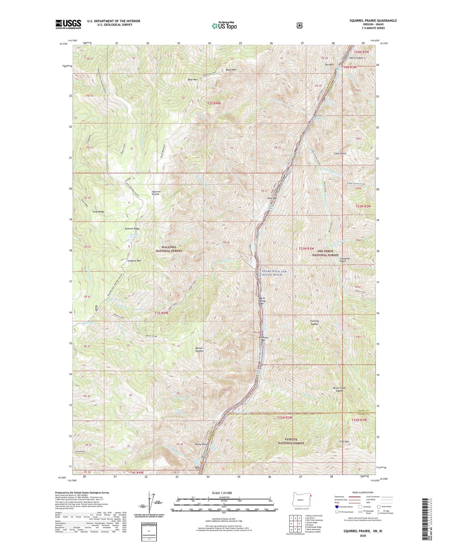
2020 topographic map quadrangle Squirrel Prairie in the states of Idaho, Oregon. Scale: 1:24000. Based on the newly updated USGS 7.5' US Topo map series, this map is in the following counties: Wallowa, Idaho, Adams. The map contains contour data, water features, and other items you are used to seeing on USGS maps, but also has updated roads and other features. This is the next generation of topographic maps. Printed on high-quality waterproof paper with UV fade-resistant inks.
Quads adjacent to this one:
West: Jaynes Ridge
Northwest: Sheep Creek Divide
North: Hat Point
Northeast: Old Timer Mountain
East: He Devil
Southeast: Purgatory Saddle
South: White Monument
Southwest: Puderbaugh Ridge
Contains the following named places: Barton Heights, Battle Creek, Bear Mountain, Beaver Dam Creek, Benjamin Spring, Black Mountain, Brush Creek, Brush Creek Rapids, Brush Creek Saddle, Bull Creek, Cache Creek, Chimney Bar, Chimney Saddle, Cliff Mountain, Cliff Mountain Rapids, Coon Gulch, Coyote Spring, Devils Farm Creek, Granite Creek, Granite Creek Rapids, Granite Rapids, Hells Canyon Creek, Hells Canyon Creek Boat Launch, Hells Canyon Creek Forest Service Station, Hells Canyon Creek Recreation Site, Hells Canyon Rapids, Hibbs Cabin, Hibbs Ranch, Jensen Spring, Lamont Spring, Lamont Springs, Little Granite Creek, Long Ridge, Lookout Mountain, Marks Cabin, Rock Bar, Rocky Point, Rocky Point Rapids, Slaughter Gulch, Squirrel Prairie, Stud Creek, Three Creek, Three Creek Rapids, Two Bars, Warm Springs Bar, Wild Sheep Creek, Wild Sheep Rapids, Wilson Cabin