MyTopo
Stony Mountain Oregon US Topo Map
Couldn't load pickup availability
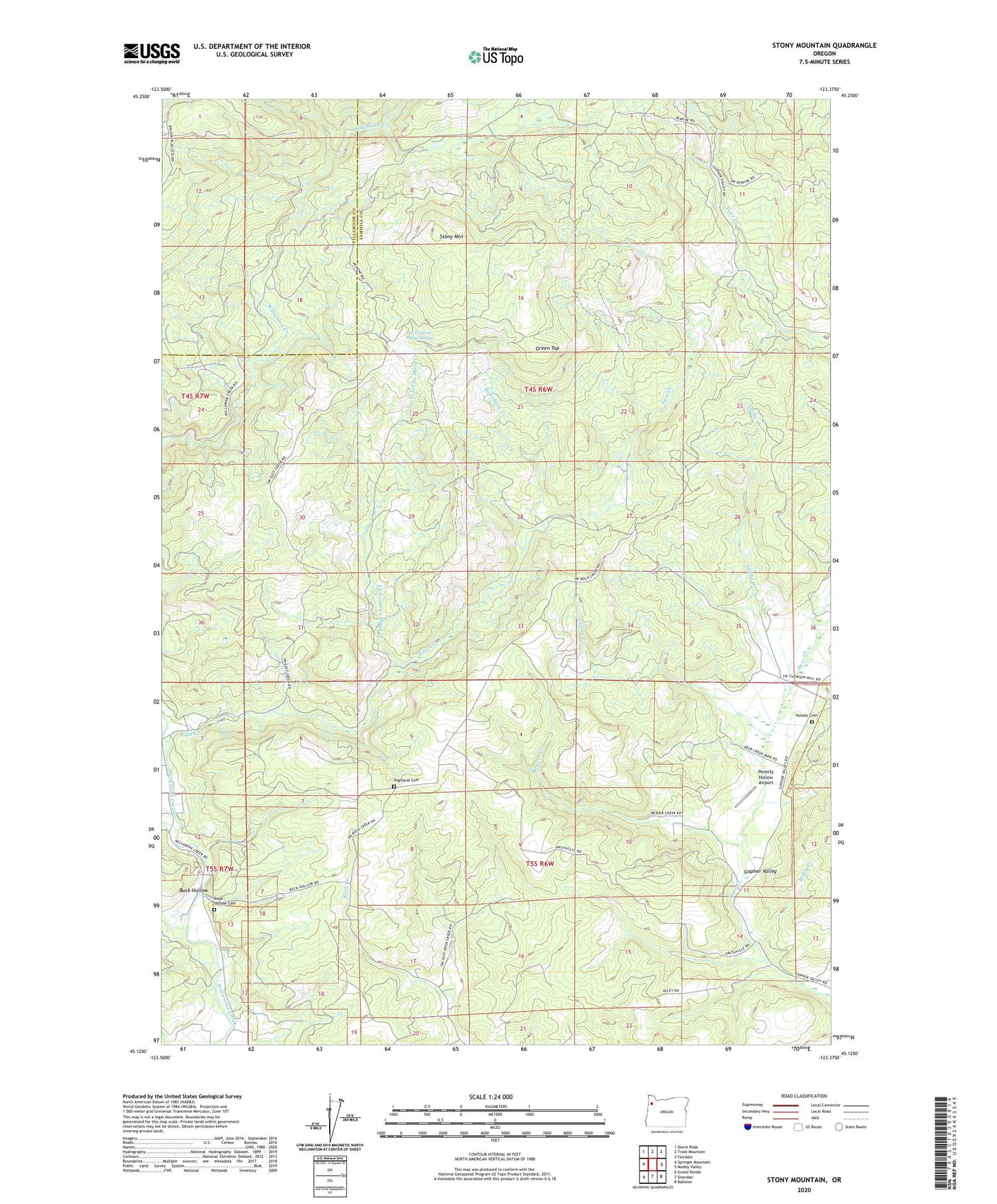
2023 topographic map quadrangle Stony Mountain in the state of Oregon. Scale: 1:24000. Based on the newly updated USGS 7.5' US Topo map series, this map is in the following counties: Yamhill, Tillamook. The map contains contour data, water features, and other items you are used to seeing on USGS maps, but also has updated roads and other features. This is the next generation of topographic maps. Printed on high-quality waterproof paper with UV fade-resistant inks.
Quads adjacent to this one:
West: Springer Mountain
Northwest: Dovre Peak
North: Trask Mountain
Northeast: Fairdale
East: Muddy Valley
Southeast: Ballston
South: Sheridan
Southwest: Grand Ronde
This map covers the same area as the classic USGS quad with code o45123b4.
Contains the following named places: Baltimore Creek, Beaver Creek, Blackwell County Park, Buck Hollow, Buck Hollow Cemetery, Cedar Creek, Coast Creek, Cronin Creek, Deer Creek County Park, East Creek, Gopher, Gopher Post Office, Gopher Valley, Green Top, Grohe Creek, Highland Cemetery, Hussey Cemetery, La Toutena Mary Creek, La Toutena Mary Spring, Poverty Hollow Airport, Stony Mountain, Wiley Creek