MyTopo
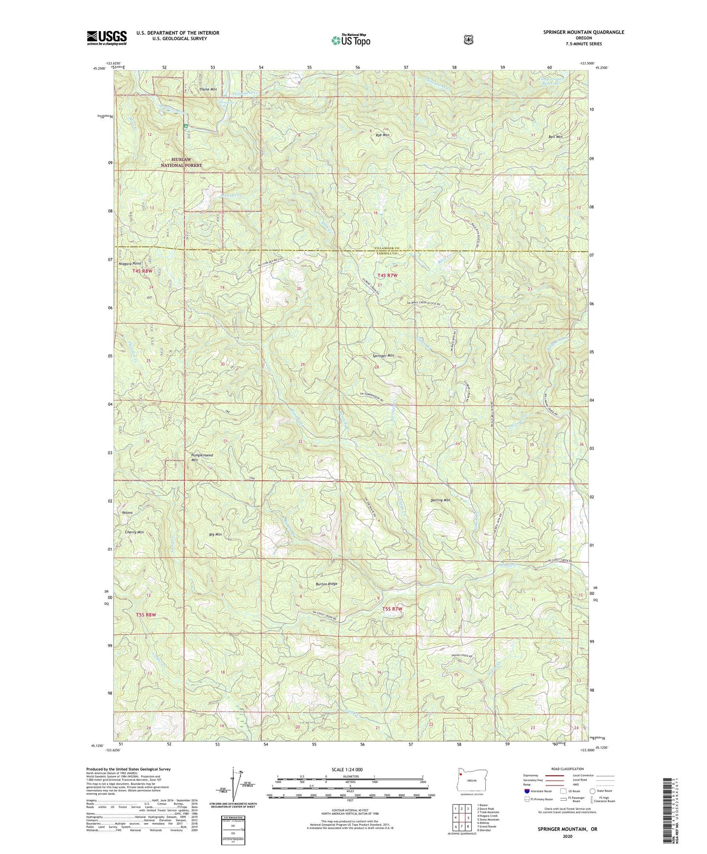
Springer Mountain Oregon US Topo Map
Couldn't load pickup availability
Also explore the Springer Mountain Forest Service Topo of this same quad for updated USFS data
2023 topographic map quadrangle Springer Mountain in the state of Oregon. Scale: 1:24000. Based on the newly updated USGS 7.5' US Topo map series, this map is in the following counties: Yamhill, Tillamook. The map contains contour data, water features, and other items you are used to seeing on USGS maps, but also has updated roads and other features. This is the next generation of topographic maps. Printed on high-quality waterproof paper with UV fade-resistant inks.
Quads adjacent to this one:
West: Niagara Creek
Northwest: Blaine
North: Dovre Peak
Northeast: Trask Mountain
East: Stony Mountain
Southeast: Sheridan
South: Grand Ronde
Southwest: Midway
This map covers the same area as the classic USGS quad with code o45123b5.
Contains the following named places: Bell Mountain, Bible Creek, Bible Ranch, Big Mountain, Bogue Creek, Burton Creek, Burton Ridge, Camp Cooper, Camp Cooper Reservoir, Canada Creek, Cherry Mountain, Coast Creek Park, Coast Creek Shelter, Coneridge School, Darling Mountain, Gilbert Creek, Kennedy Creek, Mina Creek, Muletail Creek, Nenamusa, Nenamusa Falls, Nenamusa Post Office, Niagara Point, Pumpkinseed Mountain, Rocky Bend Recreation Site, Royce Creek, Rye Mountain, Sheridan Division, Springer Creek, Springer Mountain, Testament Creek, Thune Mountain, Wilson Creek