MyTopo
Sugarpine Mountain Oregon US Topo Map
Couldn't load pickup availability
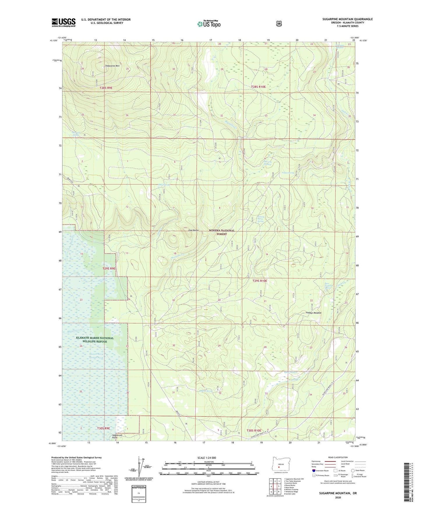
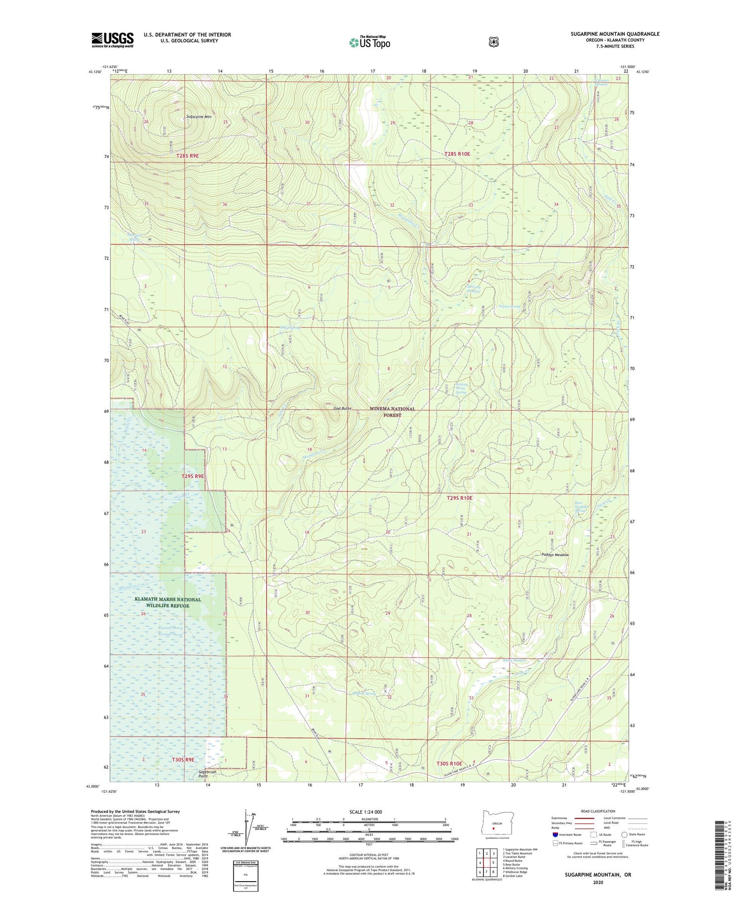
2020 topographic map quadrangle Sugarpine Mountain in the state of Oregon. Scale: 1:24000. Based on the newly updated USGS 7.5' US Topo map series, this map is in the following counties: Klamath. The map contains contour data, water features, and other items you are used to seeing on USGS maps, but also has updated roads and other features. This is the next generation of topographic maps. Printed on high-quality waterproof paper with UV fade-resistant inks.
Quads adjacent to this one:
West: Round Butte
Northwest: Sugarpine Mountain NW
North: Tea Table Mountain
Northeast: Location Butte
East: Bear Butte
Southeast: Gordon Lake
South: Wildhorse Ridge
Southwest: Military Crossing
Contains the following named places: Bedpan Burn, Bedpan Spring, Deer Scaffold Spring, God Butte, God Creek, Indian Spring, Jack Creek Corral, Junction Burn, Kicking Horse Spring, Lane Creek, Lane Well, McCarty Meadow, Mosquito Creek, Paddys Meadow, Rakes Meadow, Sagebrush Point, Sheep Spring, Sugarpine Burn, Sugarpine Mountain, Sugarpine Mountain Lookout, Surveyor Spring