MyTopo
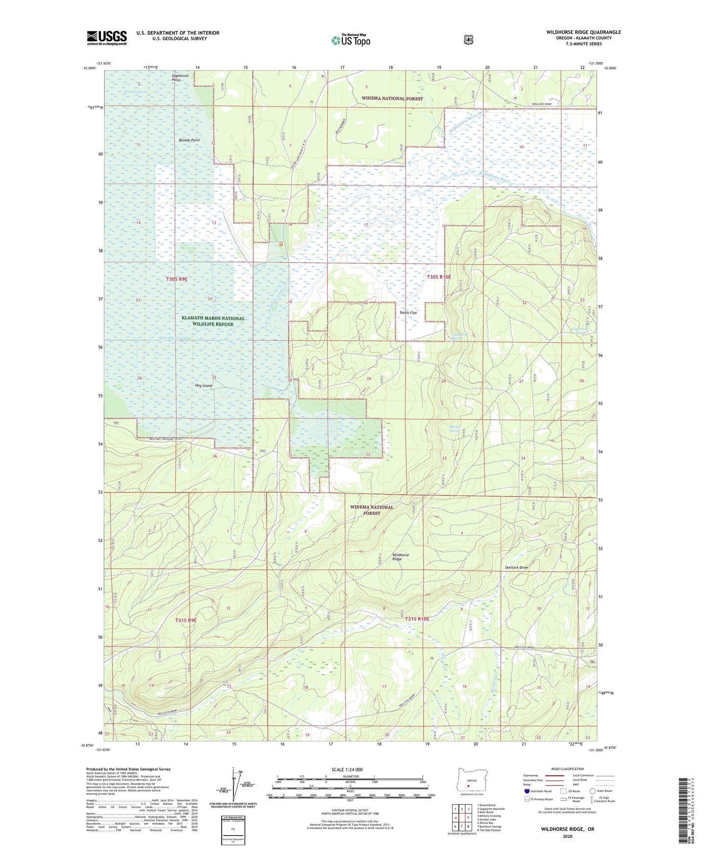
Wildhorse Ridge Oregon US Topo Map
Couldn't load pickup availability
Also explore the Wildhorse Ridge Forest Service Topo of this same quad for updated USFS data
2023 topographic map quadrangle Wildhorse Ridge in the state of Oregon. Scale: 1:24000. Based on the newly updated USGS 7.5' US Topo map series, this map is in the following counties: Klamath. The map contains contour data, water features, and other items you are used to seeing on USGS maps, but also has updated roads and other features. This is the next generation of topographic maps. Printed on high-quality waterproof paper with UV fade-resistant inks.
Quads adjacent to this one:
West: Military Crossing
Northwest: Round Butte
North: Sugarpine Mountain
Northeast: Bear Butte
East: Gordon Lake
Southeast: The Bull Pasture
South: Buckhorn Springs
Southwest: Wocus Bay
This map covers the same area as the classic USGS quad with code o42121h5.
Contains the following named places: Abraham Flat, Bloody Point, Bluejay Spring, Bluejay Spring Research Natural Area, Clover Creek, Copeland Spring, Hog Island, Jack Creek, Johnson Barn, Kittredge Canal, Kittredge Ranch, Meadow Creek, South Flat, South Fork Spring, Summers Ranch, Wildhorse Ridge, Williamson River Ditch, Y J Canal