MyTopo
Crater Lake East Oregon US Topo Map
Couldn't load pickup availability
Also explore the Crater Lake East Forest Service Topo of this same quad for updated USFS data
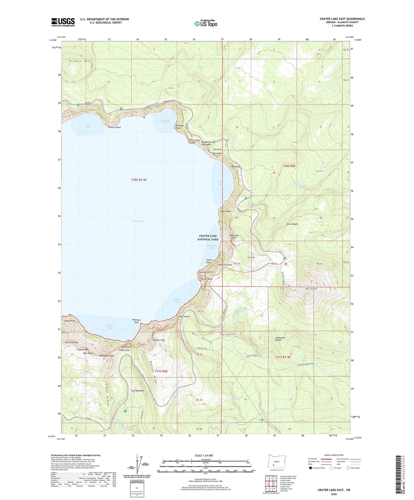
2024 topographic map quadrangle Crater Lake East in the state of Oregon. Scale: 1:24000. Based on the newly updated USGS 7.5' US Topo map series, this map is in the following counties: Klamath. The map contains contour data, water features, and other items you are used to seeing on USGS maps, but also has updated roads and other features. This is the next generation of topographic maps. Printed on high-quality waterproof paper with UV fade-resistant inks.
Quads adjacent to this one:
West: Crater Lake West
Northwest: Pumice Desert West
North: Pumice Desert East
Northeast: Welch Butte
East: Pothole Butte
Southeast: Sun Pass
South: Maklaks Crater
Southwest: Union Peak
This map covers the same area as the classic USGS quad with code o42122h1.
Contains the following named places: Anderson Bluffs, Anderson Spring, Applegate Peak, Base of Mount Mazama, Bear Creek Trail, Cascade Spring, Castle Rock, Chaski Bay, Cleetwood Cove, Cloudcap, Cloudcap Bay, Crater Lake, Danger Bay, Dutton Cliff, Dutton Ridge, Dyar Rock, Eagle Crags, Eagle Point, Garfield Peak, Garfield Peak Trail, Grotto Cove, Grouse Hill, Kerr Notch, Kerr Valley, Lost Creek Ranger Station, Lost Creek Recreation Site, Lost Creek Spring, Mazama Rock, Mount Mazama, Mount Scott, Mount Scott Lookout, Mount Scott Trail, Palisade Point, Palisades, Phantom Ship, Pumice Castle, Pumice Point, Redcloud Cliff, Roundtop, Rugged Crest, Rugged Crest Palisades, Scott Bluffs, Sentinel Rock, Skell Head, Steel Bay, Sun Meadows, Sun Notch, Sun Notch Trail, Victor View, Vidae Cliff, Vidae Ridge, Wineglass