MyTopo
Sutton Mountain Oregon US Topo Map
Couldn't load pickup availability
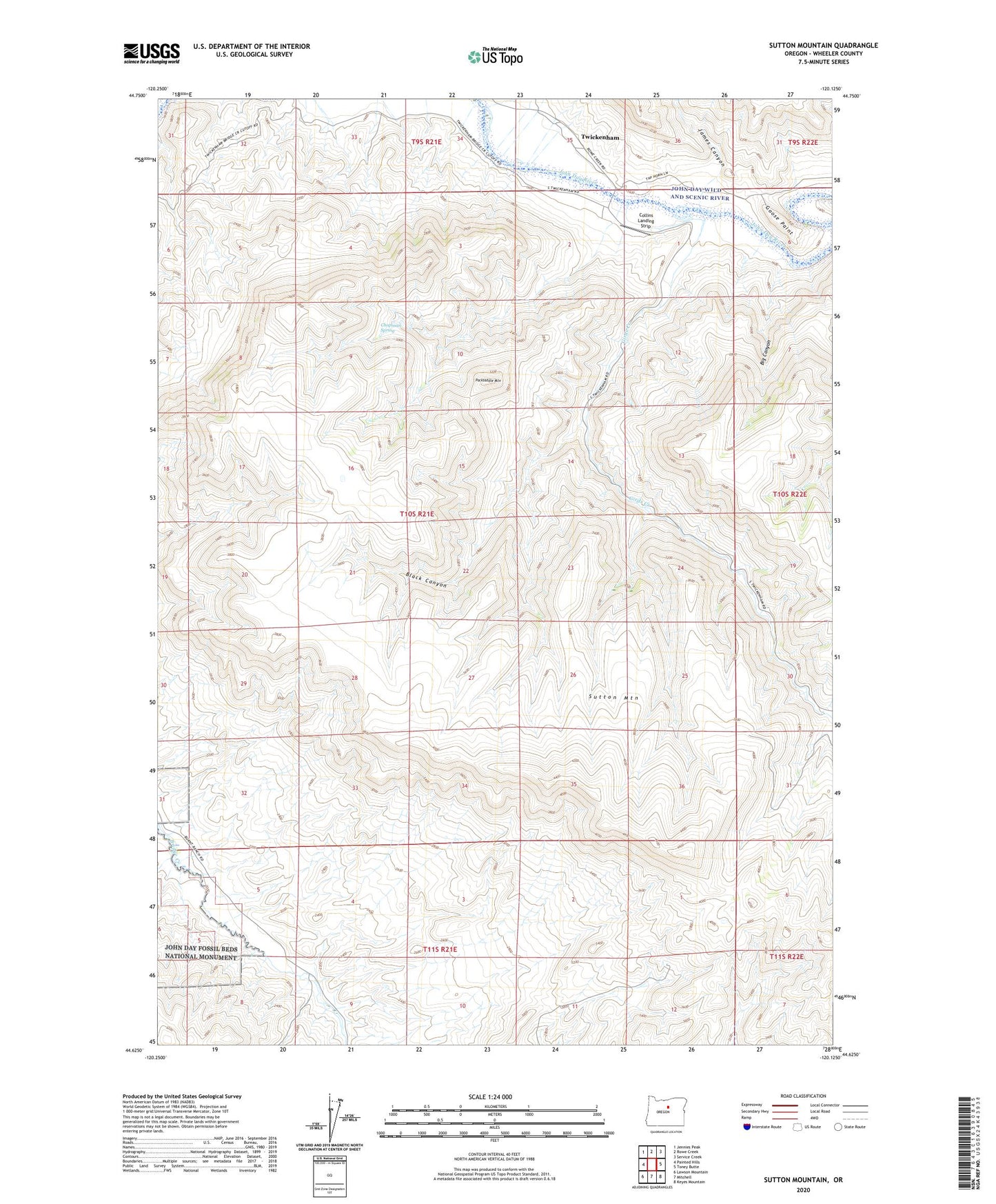
2020 topographic map quadrangle Sutton Mountain in the state of Oregon. Scale: 1:24000. Based on the newly updated USGS 7.5' US Topo map series, this map is in the following counties: Wheeler. The map contains contour data, water features, and other items you are used to seeing on USGS maps, but also has updated roads and other features. This is the next generation of topographic maps. Printed on high-quality waterproof paper with UV fade-resistant inks.
Quads adjacent to this one:
West: Painted Hills
Northwest: Jennies Peak
North: Rowe Creek
Northeast: Service Creek
East: Toney Butte
Southeast: Keyes Mountain
South: Mitchell
Southwest: Lawson Mountain
Contains the following named places: Big Canyon, Black Canyon, Chapman Spring, Collins Landing Strip, Girds Creek, Goose Paint, James Canyon, Packsaddle Mountain, Sutton Mountain, Twickenham, Twickenham Boat Launch, Twickenham Post Office, ZIP Code: 97750