MyTopo
Table Mountain Oregon US Topo Map
Couldn't load pickup availability
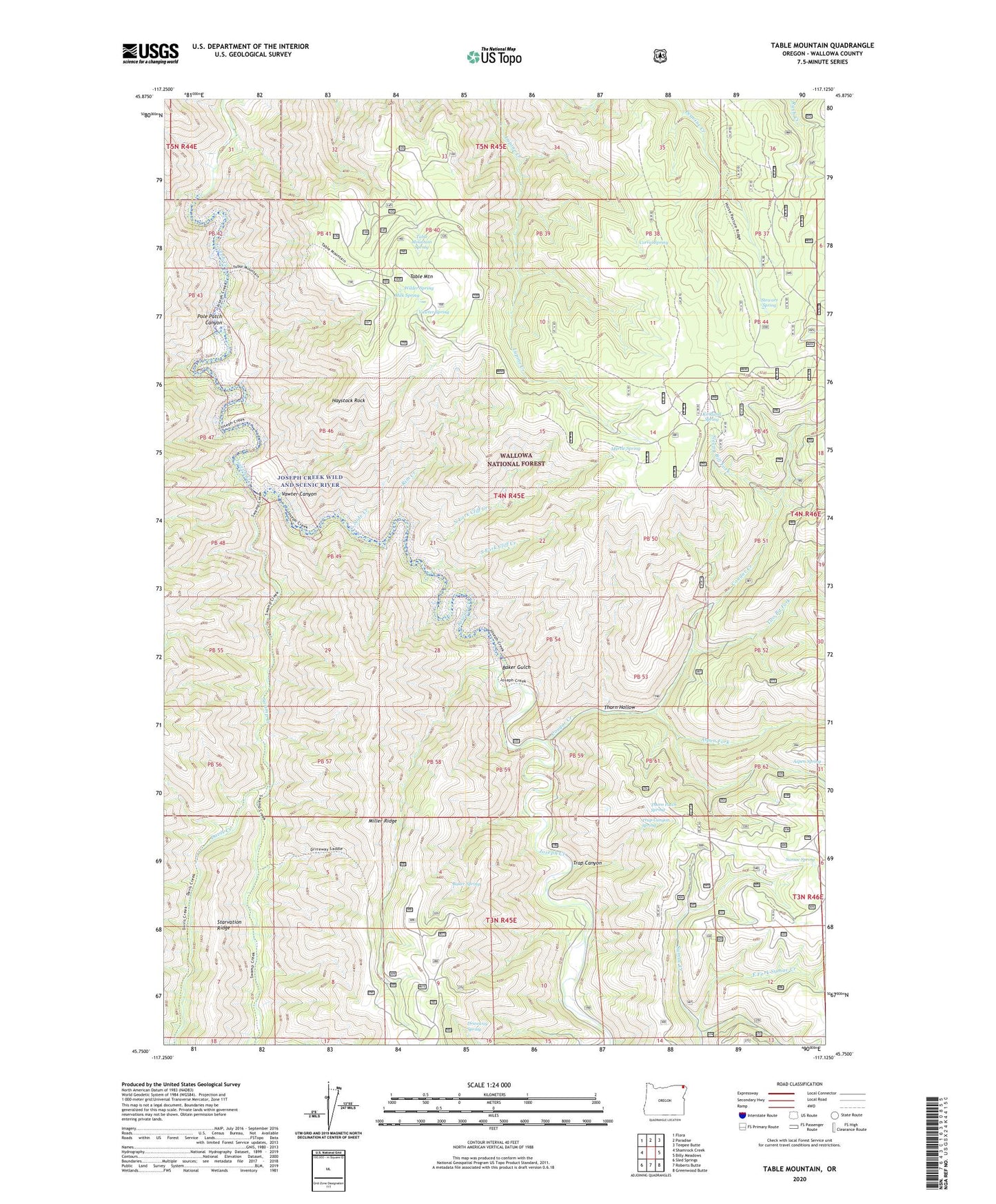
2020 topographic map quadrangle Table Mountain in the state of Oregon. Scale: 1:24000. Based on the newly updated USGS 7.5' US Topo map series, this map is in the following counties: Wallowa. The map contains contour data, water features, and other items you are used to seeing on USGS maps, but also has updated roads and other features. This is the next generation of topographic maps. Printed on high-quality waterproof paper with UV fade-resistant inks.
Quads adjacent to this one:
West: Shamrock Creek
Northwest: Flora
North: Paradise
Northeast: Teepee Butte
East: Billy Meadows
Southeast: Greenwood Butte
South: Roberts Butte
Southwest: Sled Springs
Contains the following named places: Aspen Fork, Baker Gulch, Baker Spring, Corral Spring, Cougar Creek, Davis Creek, Dog Fight Corral, Driveway Spring, East Fork Sumac Creek, Haystack Rock, Joseph Creek Wild And Scenic River, Kirkland Cabin, Kirkland Campground, Kirkland Lookout Tower, Kirkland Spring, Milk Spring, Miller Ridge, Myrtle Spring, North Fork Cliff Creek, Pole Patch Canyon, Rim Creek, Sleepy Bill Fork, Slide Creek, South Fork Cliff Creek, Stewart Spring, Sumac Spring, Swamp Creek, Table Mountain, Table Mountain Spring, Thorn Hollow, Thorn Patch Spring, Trap Canyon, Trap Canyon Spring, Two Bit Fork, Vawter Canyon, Vawter Spring, Wilder Spring