MyTopo
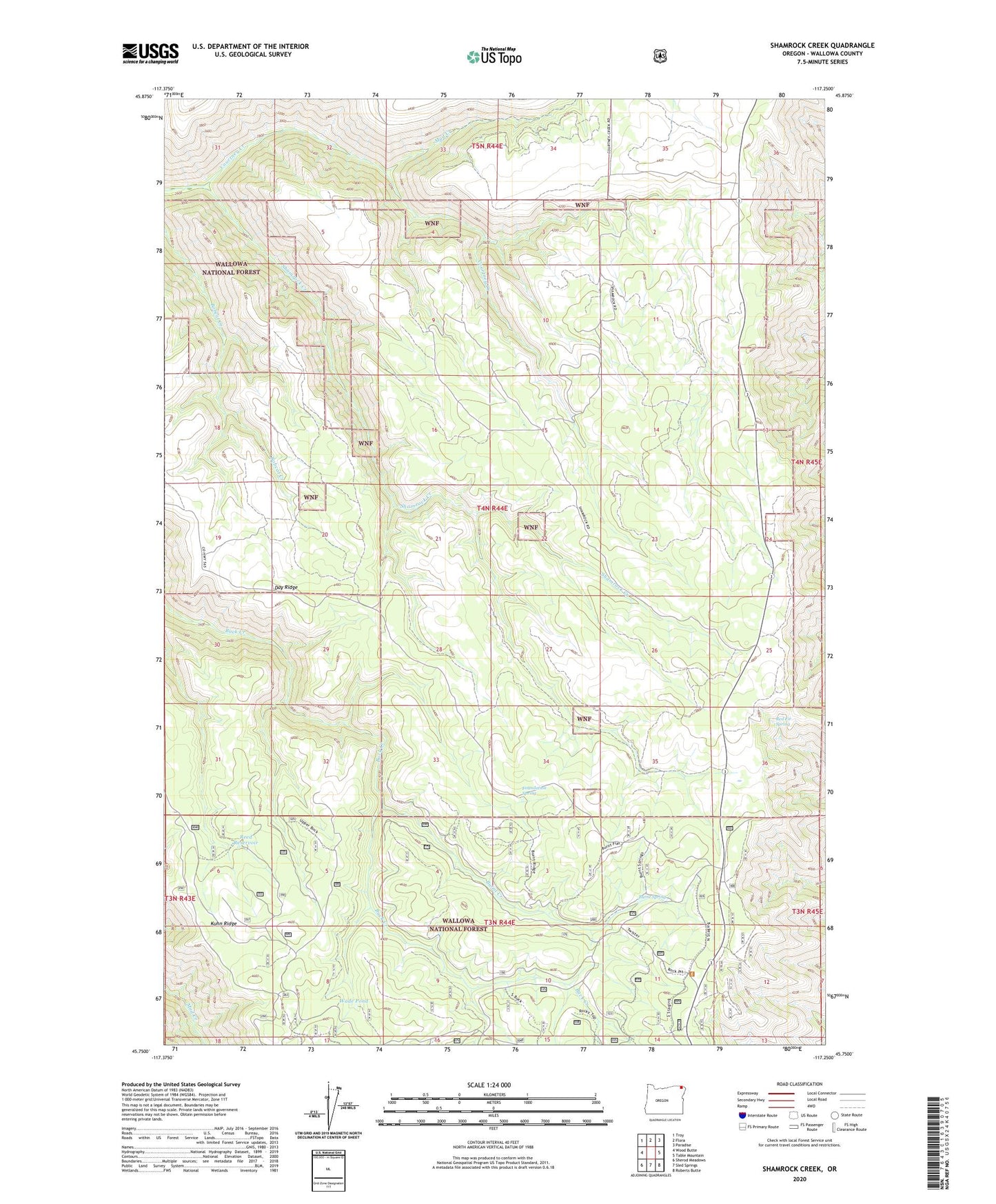
Shamrock Creek Oregon US Topo Map
Couldn't load pickup availability
Also explore the Shamrock Creek Forest Service Topo of this same quad for updated USFS data
2024 topographic map quadrangle Shamrock Creek in the state of Oregon. Scale: 1:24000. Based on the newly updated USGS 7.5' US Topo map series, this map is in the following counties: Wallowa. The map contains contour data, water features, and other items you are used to seeing on USGS maps, but also has updated roads and other features. This is the next generation of topographic maps. Printed on high-quality waterproof paper with UV fade-resistant inks.
Quads adjacent to this one:
West: Wood Butte
Northwest: Troy
North: Flora
Northeast: Paradise
East: Table Mountain
Southeast: Roberts Butte
South: Sled Springs
Southwest: Sherod Meadows
This map covers the same area as the classic USGS quad with code o45117g3.
Contains the following named places: Appleton Post Office, Burnt Creek, Burnt Spring, Day Ridge, Flora Division, Foundation Spring, Joseph Canyon Viewpoint, Mud Creek, Red Fir Spring, Reed Reservoir, Shamrock Creek, Wade Pond