MyTopo
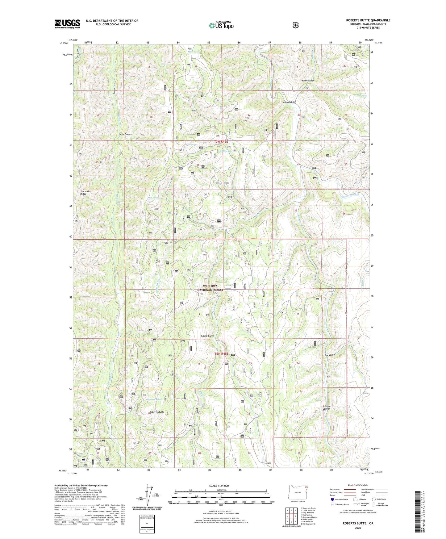
Roberts Butte Oregon US Topo Map
Couldn't load pickup availability
Also explore the Roberts Butte Forest Service Topo of this same quad for updated USFS data
2024 topographic map quadrangle Roberts Butte in the state of Oregon. Scale: 1:24000. Based on the newly updated USGS 7.5' US Topo map series, this map is in the following counties: Wallowa. The map contains contour data, water features, and other items you are used to seeing on USGS maps, but also has updated roads and other features. This is the next generation of topographic maps. Printed on high-quality waterproof paper with UV fade-resistant inks.
Quads adjacent to this one:
West: Sled Springs
Northwest: Shamrock Creek
North: Table Mountain
Northeast: Billy Meadows
East: Greenwood Butte
Southeast: Elk Mountain SE
South: Elk Mountain
Southwest: Hicks Spring
This map covers the same area as the classic USGS quad with code o45117f2.
Contains the following named places: Alford Gulch, Baker Ranch, Boner Gulch, Cement Spring, Chesnimnus Creek, Chico, Chico Camp, Chico Guard Station, Chico Post Office, Chico Trail, Cold Spring, Crow Creek, Davis Ranch, Doe Gulch, Double Spring, Elk Creek, Elk Spring, Fine Ranch, Gould Gulch, Johnson Canyon, Little Elk Creek, M Birkmaier Ranch, Miller Spring, Mud Spring, Nells Canyon, Paulson Ranch, Roberts Butte, Roberts Pond, Sumac Creek, Swamp Creek Cow Camp, Twin Spring, ZIP Code: 97828