MyTopo
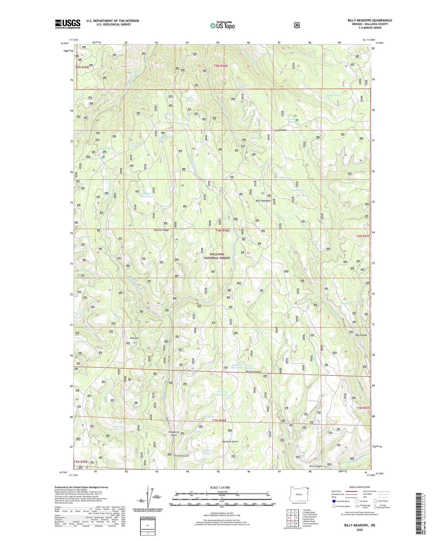
Billy Meadows Oregon US Topo Map
Couldn't load pickup availability
Also explore the Billy Meadows Forest Service Topo of this same quad for updated USFS data
2023 topographic map quadrangle Billy Meadows in the state of Oregon. Scale: 1:24000. Based on the newly updated USGS 7.5' US Topo map series, this map is in the following counties: Wallowa. The map contains contour data, water features, and other items you are used to seeing on USGS maps, but also has updated roads and other features. This is the next generation of topographic maps. Printed on high-quality waterproof paper with UV fade-resistant inks.
Quads adjacent to this one:
West: Table Mountain
Northwest: Paradise
North: Teepee Butte
Northeast: Jim Creek Butte
East: Poison Point
Southeast: Zumwalt
South: Greenwood Butte
Southwest: Roberts Butte
This map covers the same area as the classic USGS quad with code o45117g1.
Contains the following named places: Alder Spring, Aspen Spring, Baldwin Spring, Bear Spring, Bed Spring, Billy Meadows, Billy Meadows Guard Station, Coyote Recreation Site, Coyote Spring, Dougherty Recreation Site, Dougherty Spring, East Fork Broady Creek, East Fork Peavine Creek, Elk Spring, Ellis Canyon, French Gulch, Getchel Meadows, Getchel Ridge, Hay Pen Camp, Hinton Spring, Hollow Log Cow Camp, Hollow Log Spring, Kernan Spring, Lone Spring, Long Ridge, Long Ridge Spring, McCarty Reservoir, Paris Spring, Poker Bill Spring, Quirk Spring, Red Hill, Red Hill Recreation Site, Snow Spring, Teepee Spring, Telephone Gulch, Trough Spring, Volstead Reservoir, Warnock Spring, West Fork Peavine Creek, Yew Wood Spring