MyTopo
Thimbleberry Mountain Oregon US Topo Map
Couldn't load pickup availability
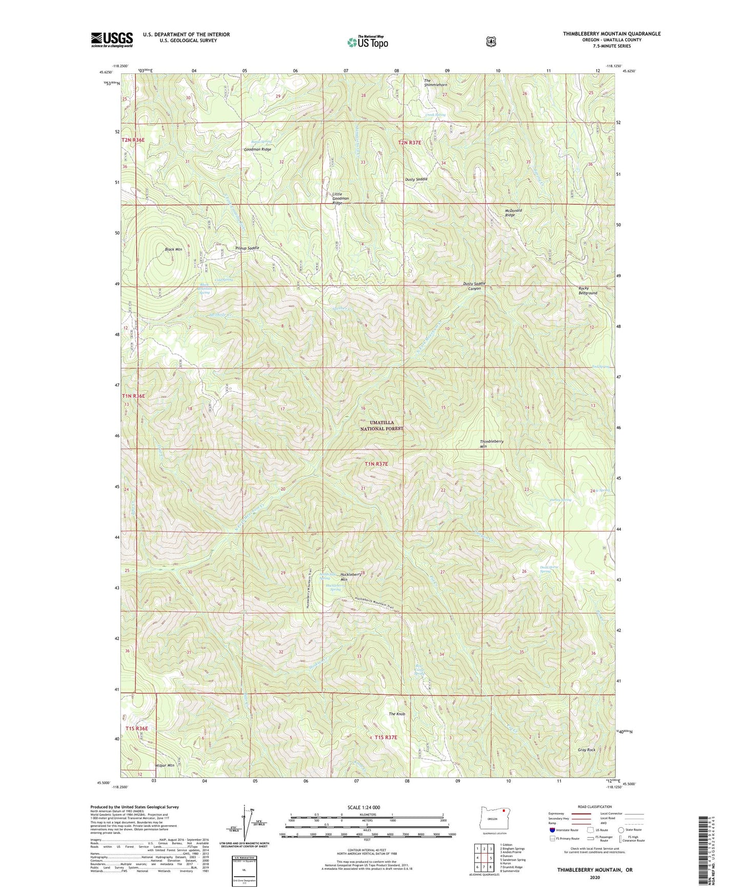
2020 topographic map quadrangle Thimbleberry Mountain in the state of Oregon. Scale: 1:24000. Based on the newly updated USGS 7.5' US Topo map series, this map is in the following counties: Umatilla. The map contains contour data, water features, and other items you are used to seeing on USGS maps, but also has updated roads and other features. This is the next generation of topographic maps. Printed on high-quality waterproof paper with UV fade-resistant inks.
Quads adjacent to this one:
West: Duncan
Northwest: Gibbon
North: Bingham Springs
Northeast: Andies Prairie
East: Sanderson Spring
Southeast: Summerville
South: Drumhill Ridge
Southwest: Huron
Contains the following named places: Banjo Spring, Bear Camp Spring, Bear Creek, Black Mountain, Black Mountain Spring, Canyon Creek, Cold Spring, Creek Spring, Dead Horse Spring, Dusty Saddle, Dusty Saddle Canyon, End Spring, Farley Spring, Goodman Lookout Tower, Goodman Ridge, Gray Rock, Hellhole Creek, Hoskins Creek, Huckleberry Mountain, Huckleberry Spring, Jake Creek, Little Goodman Ridge, McDonald Ridge, North Side Spring, Pileup Saddle, Pole Spring, Pot Creek, Rocky Bedground, Slusher Creek, The Knob, The Shimmiehorn, Thimbleberry Mountain, Trap Creek, Wilbur Mountain