MyTopo
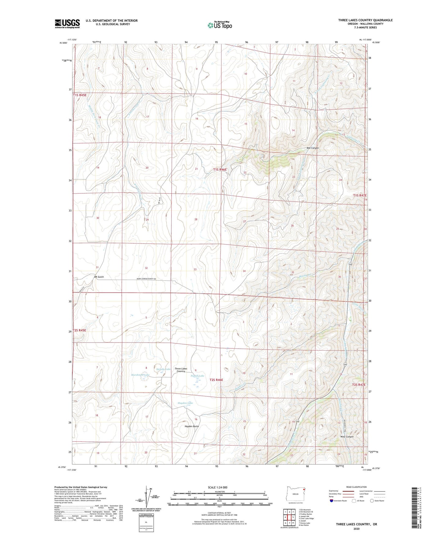
Three Lakes Country Oregon US Topo Map
Couldn't load pickup availability
Also explore the Three Lakes Country Forest Service Topo of this same quad for updated USFS data
2023 topographic map quadrangle Three Lakes Country in the state of Oregon. Scale: 1:24000. Based on the newly updated USGS 7.5' US Topo map series, this map is in the following counties: Wallowa. The map contains contour data, water features, and other items you are used to seeing on USGS maps, but also has updated roads and other features. This is the next generation of topographic maps. Printed on high-quality waterproof paper with UV fade-resistant inks.
Quads adjacent to this one:
West: Joseph NW
Northwest: Elk Mountain
North: Elk Mountain SE
Northeast: Findley Buttes
East: Clear Lake Ridge
Southeast: Harl Butte
South: Kinney Lake
Southwest: Joseph
This map covers the same area as the classic USGS quad with code o45117d1.
Contains the following named places: Box Canyon, Brushy Creek, Hayden Butte, Hayden Creek, Hayden Lake, Lightning Creek Ranch, Little Horse Creek, Marshman Lake, North Fork Lightning Creek, Nuxall Lake, South Fork Lightning Creek, Sprudy Lake, Three Lakes Country, Threebuck Creek, Wolf Canyon, ZIP Code: 97846