
MyTopo
Timothy Lake Oregon US Topo Map
Couldn't load pickup availability
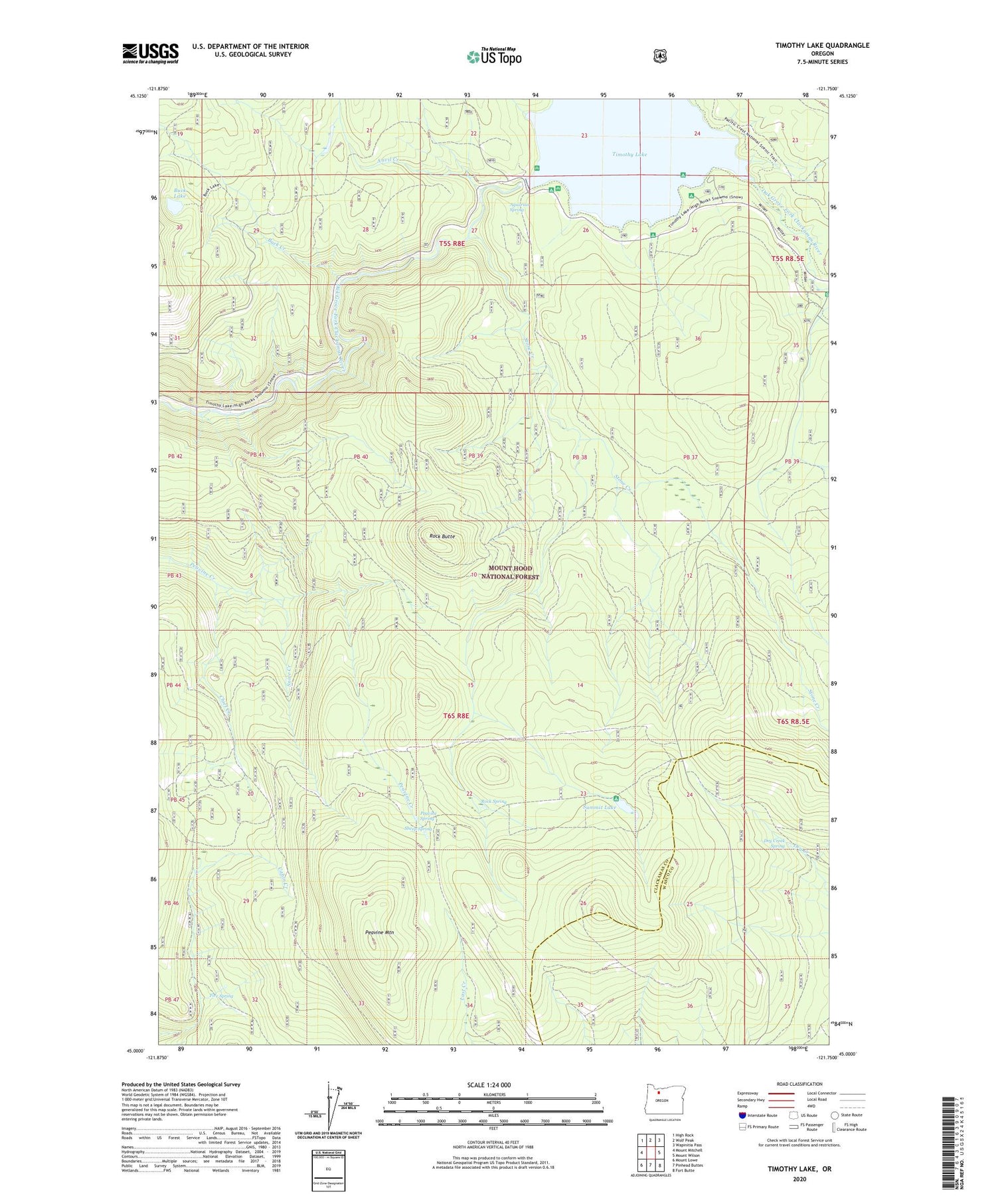
2020 topographic map quadrangle Timothy Lake in the state of Oregon. Scale: 1:24000. Based on the newly updated USGS 7.5' US Topo map series, this map is in the following counties: Clackamas, Wasco. The map contains contour data, water features, and other items you are used to seeing on USGS maps, but also has updated roads and other features. This is the next generation of topographic maps. Printed on high-quality waterproof paper with UV fade-resistant inks.
Quads adjacent to this one:
West: Mount Mitchell
Northwest: High Rock
North: Wolf Peak
Northeast: Wapinitia Pass
East: Mount Wilson
Southeast: Fort Butte
South: Pinhead Buttes
Southwest: Mount Lowe
Contains the following named places: Alligator Quarry, Anvil Creek, Aquarius Spring, Buck Creek, Buck Creek Quarry, Buck Lake, Chief Creek, Cove Recreation Site, Dinger Creek, Dry Creek Spring, Fire Spring, Gemini Quarries, Gone Creek Boat Launch, Gone Creek Recreation Site, Hood View Recreation Site, Hoodview Campground Boat Launch, Oak Fork Boat Launch, Oak Fork Recreation Site, Peavine Mountain, Peavine Spring, Pine Point Boat Launch, Pine Point Recreation Site, Rimtie Quarry, Rock Butte, Rock Spring, Rock Springs Trail, Sheep Spring, Skyline Alternate Trail, Snive Creek, Stone Creek, Stone Creek Gravel Pit, Summit Lake, Summit Lake Recreation Site, Summit Lake Trail, Timothy Lake, Timothy Lake Dam, Timothy Meadows, Warm Springs Meadow Trail


