MyTopo
Fort Butte Oregon US Topo Map
Couldn't load pickup availability
Also explore the Fort Butte Forest Service Topo of this same quad for updated USFS data
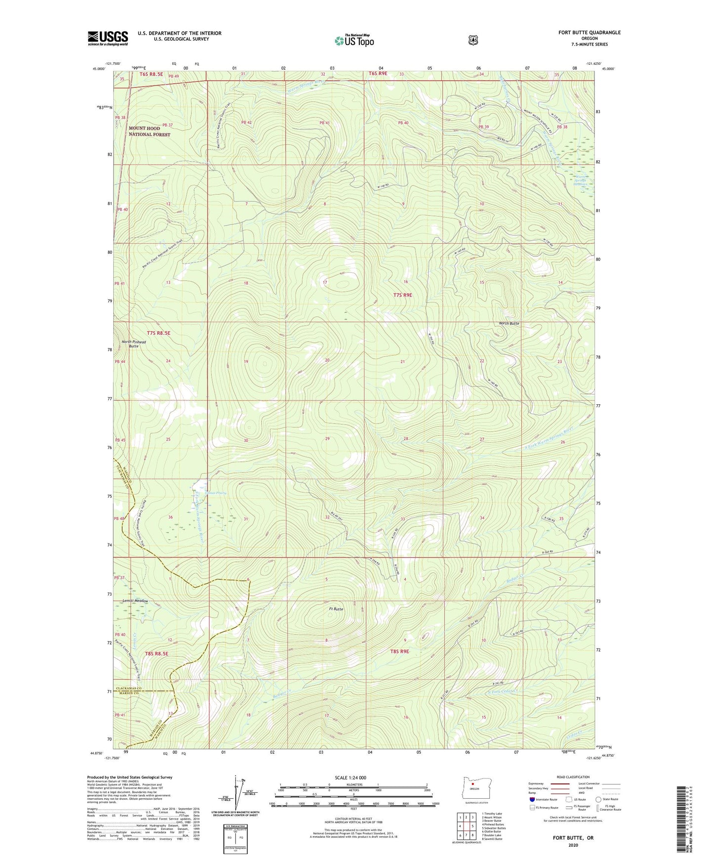
2024 topographic map quadrangle Fort Butte in the state of Oregon. Scale: 1:24000. Based on the newly updated USGS 7.5' US Topo map series, this map is in the following counties: Wasco, Clackamas, Marion. The map contains contour data, water features, and other items you are used to seeing on USGS maps, but also has updated roads and other features. This is the next generation of topographic maps. Printed on high-quality waterproof paper with UV fade-resistant inks.
Quads adjacent to this one:
West: Pinhead Buttes
Northwest: Timothy Lake
North: Mount Wilson
Northeast: Beaver Butte
East: Sidwalter Buttes
Southeast: Sawmill Butte
South: Boulder Lake
Southwest: Olallie Butte
This map covers the same area as the classic USGS quad with code o44121h6.
Contains the following named places: Bunchgrass Creek, Bypass Trail, Camas Prairie, Camas Prairie Trail, Fort Butte, North Butte