MyTopo
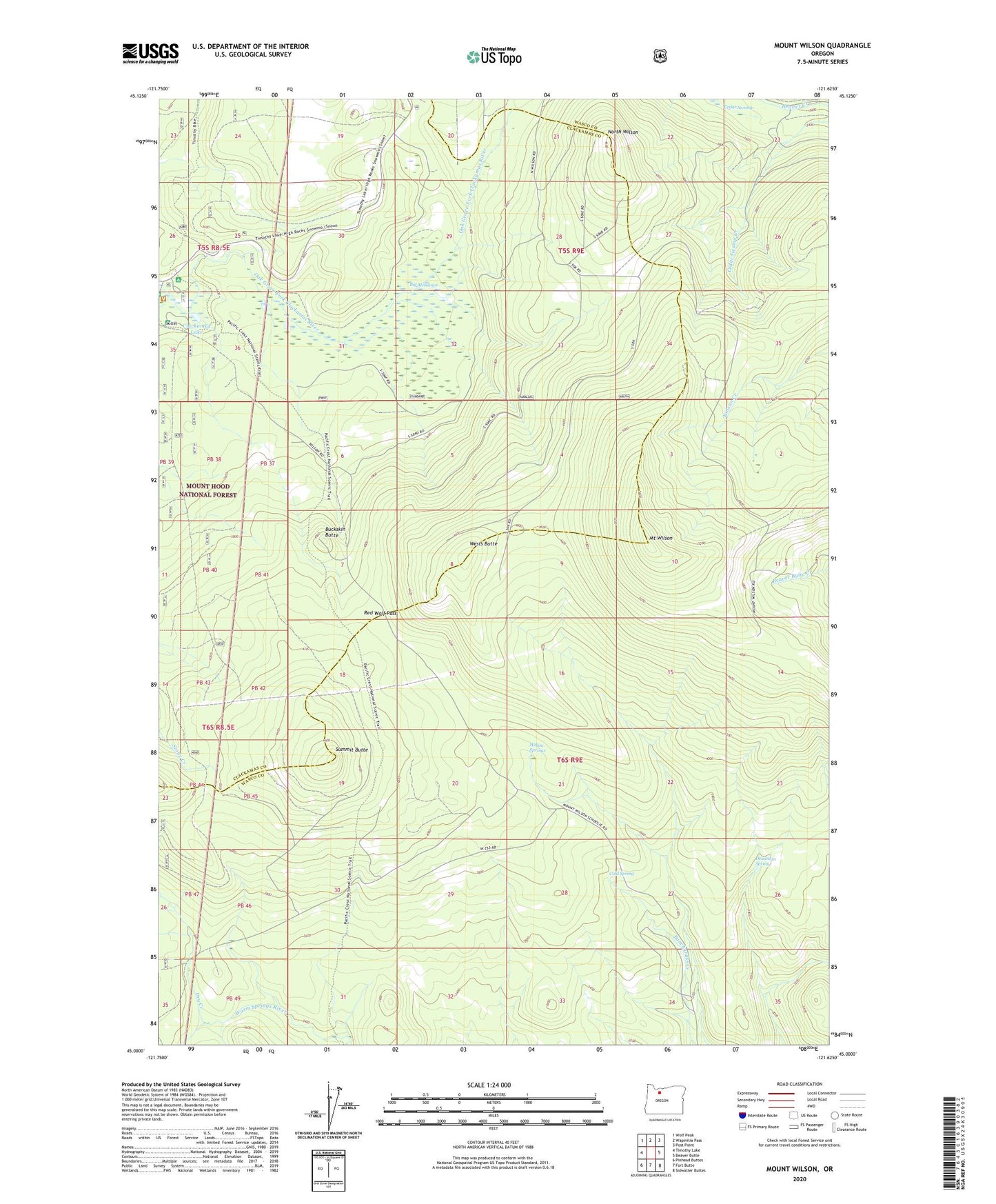
Mount Wilson Oregon US Topo Map
Couldn't load pickup availability
Also explore the Mount Wilson Forest Service Topo of this same quad for updated USFS data
2023 topographic map quadrangle Mount Wilson in the state of Oregon. Scale: 1:24000. Based on the newly updated USGS 7.5' US Topo map series, this map is in the following counties: Wasco, Clackamas. The map contains contour data, water features, and other items you are used to seeing on USGS maps, but also has updated roads and other features. This is the next generation of topographic maps. Printed on high-quality waterproof paper with UV fade-resistant inks.
Quads adjacent to this one:
West: Timothy Lake
Northwest: Wolf Peak
North: Wapinitia Pass
Northeast: Post Point
East: Beaver Butte
Southeast: Sidwalter Buttes
South: Fort Butte
Southwest: Pinhead Buttes
This map covers the same area as the classic USGS quad with code o45121a6.
Contains the following named places: Big Meadows, Buckskin Butte, Cedar Swamp, Clackamas Lake, Clackamas Lake Recreation Site, Cold Spring, Deadman Spring, Driveway Trail, Dry Creek, Joe Graham Horse Camp, Mount Wilson, Mount Wilson Trail, North Wilson, Potters Camp, Red Wolf Pass, Summit Butte, Wests Butte, Willow Springs, Wilson Cove Trail, Wilson Creek Driveway