MyTopo
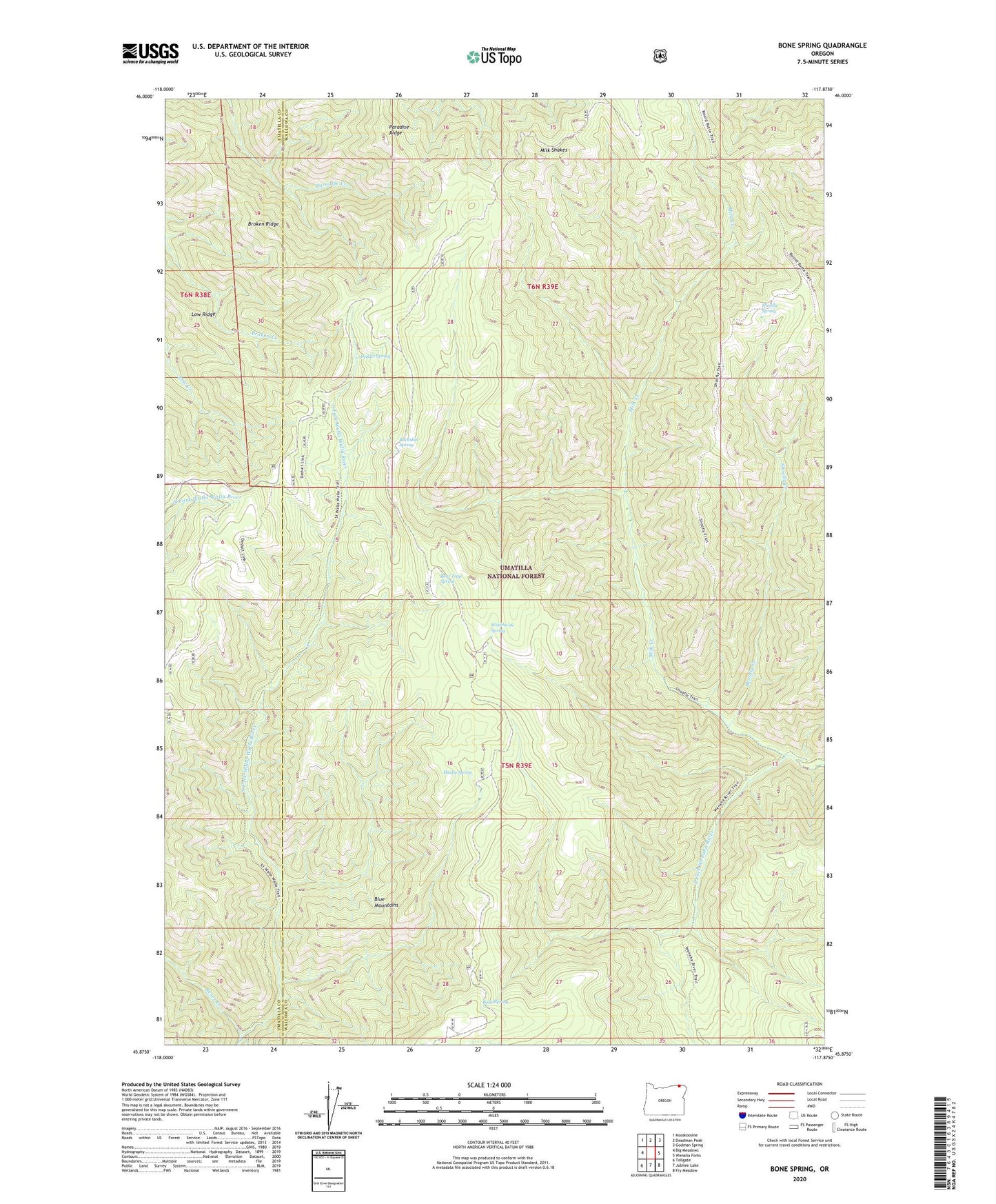
Bone Spring Oregon US Topo Map
Couldn't load pickup availability
Also explore the Bone Spring Forest Service Topo of this same quad for updated USFS data
2024 topographic map quadrangle Bone Spring in the state of Oregon. Scale: 1:24000. Based on the newly updated USGS 7.5' US Topo map series, this map is in the following counties: Wallowa, Umatilla. The map contains contour data, water features, and other items you are used to seeing on USGS maps, but also has updated roads and other features. This is the next generation of topographic maps. Printed on high-quality waterproof paper with UV fade-resistant inks.
Quads adjacent to this one:
West: Big Meadows
Northwest: Kooskooskie
North: Deadman Peak
Northeast: Godman Spring
East: Wenaha Forks
Southeast: Fry Meadow
South: Jubilee Lake
Southwest: Tollgate
This map covers the same area as the classic USGS quad with code o45117h8.
Contains the following named places: Bear Trap Spring, Bone Spring, Bone Spring Campground, Bone Spring Lookout, Broken Ridge, Buckskin Spring, Deduct Forest Camp, Deduct Spring, Husky Spring, Low Ridge, Milk Creek, Milk Shakes, Paradise Ridge, Reser Cabin, Reser Creek, Sheep Creek, Shoofly Creek, Shoofly Spring, Skyline Recreation Site, Winaha'ay Spring