MyTopo
Trask Mountain Oregon US Topo Map
Couldn't load pickup availability
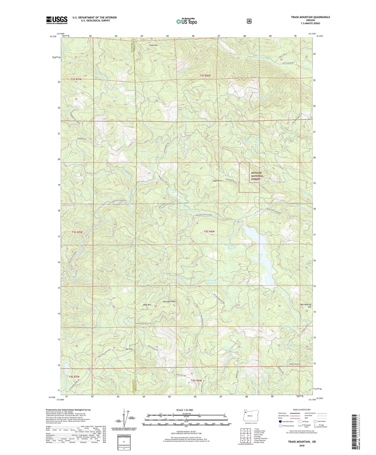
2020 topographic map quadrangle Trask Mountain in the state of Oregon. Scale: 1:24000. Based on the newly updated USGS 7.5' US Topo map series, this map is in the following counties: Yamhill, Tillamook. The map contains contour data, water features, and other items you are used to seeing on USGS maps, but also has updated roads and other features. This is the next generation of topographic maps. Printed on high-quality waterproof paper with UV fade-resistant inks.
Quads adjacent to this one:
West: Dovre Peak
Northwest: Trask
North: Gobblers Knob
Northeast: Turner Creek
East: Fairdale
Southeast: Muddy Valley
South: Stony Mountain
Southwest: Springer Mountain
Contains the following named places: Bald Mountain, Ball Bearing Hill, Cedar Creek, Dovre Campground, Dovre Peak Wayside, Elk Flat, Fan Creek, Fan Creek Campground, Ginger Creek, Maroney Creek, McGuire Dam, McGuire Reservoir, Meadow Lake, Murphy Camp Creek, Perkins Creek, Sheridan Peak, Snap Point, Steep Creek, Such Joja Reservoir, Trask Mountain, Trask Mountain Lookout, Walker Creek, Walker Creek Reservoir, Walker Flat