MyTopo
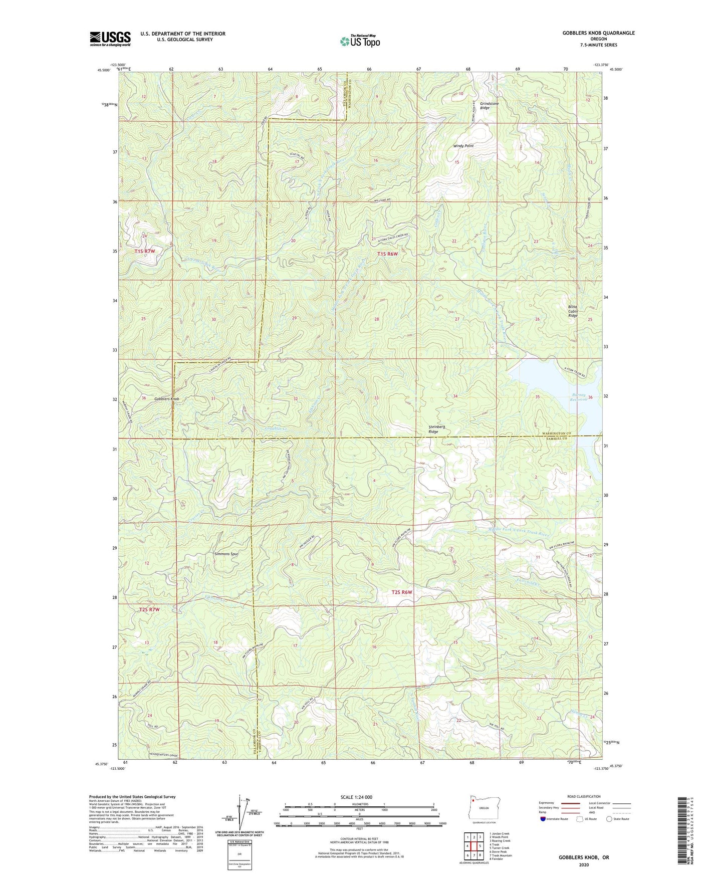
Gobblers Knob Oregon US Topo Map
Couldn't load pickup availability
2024 topographic map quadrangle Gobblers Knob in the state of Oregon. Scale: 1:24000. Based on the newly updated USGS 7.5' US Topo map series, this map is in the following counties: Washington, Yamhill, Tillamook. The map contains contour data, water features, and other items you are used to seeing on USGS maps, but also has updated roads and other features. This is the next generation of topographic maps. Printed on high-quality waterproof paper with UV fade-resistant inks.
Quads adjacent to this one:
West: Trask
Northwest: Jordan Creek
North: Woods Point
Northeast: Roaring Creek
East: Turner Creek
Southeast: Fairdale
South: Trask Mountain
Southwest: Dovre Peak
This map covers the same area as the classic USGS quad with code o45123d4.
Contains the following named places: Barney Reservoir, Clear Creek, Coffee Creek, Cruiser Creek, Elkhorn Creek, Gobblers Knob, Ki-a-Kuts Falls, Larch Post Office, Laughlin Creek, Maple Creek, Middle Fork North Fork Trask River, Murphys Camp, North Fork North Fork Trask River, Scott Creek, Simmons Spur, Steinberg Ridge, Trask River Dam, Windy Point