MyTopo
Turner Creek Oregon US Topo Map
Couldn't load pickup availability
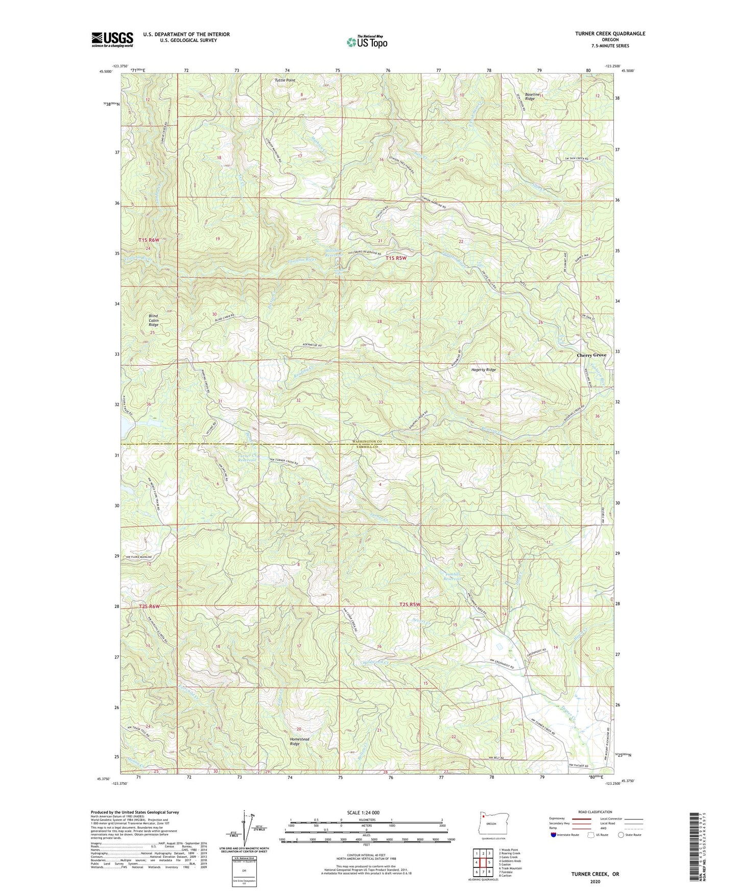
2020 topographic map quadrangle Turner Creek in the state of Oregon. Scale: 1:24000. Based on the newly updated USGS 7.5' US Topo map series, this map is in the following counties: Washington, Yamhill. The map contains contour data, water features, and other items you are used to seeing on USGS maps, but also has updated roads and other features. This is the next generation of topographic maps. Printed on high-quality waterproof paper with UV fade-resistant inks.
Quads adjacent to this one:
West: Gobblers Knob
Northwest: Woods Point
North: Roaring Creek
Northeast: Gales Creek
East: Gaston
Southeast: Carlton
South: Fairdale
Southwest: Trask Mountain
Contains the following named places: Blind Cabin Ridge, East Fork Sain Creek, Four Corners, Hagerty Ridge, Haines Falls, Hawn Creek, Hay Creek, Hillsboro Reservoir, Homestead Ridge, Joint Water Commission Cherry Grove Slow Sand Filter Plant, Lee Creek, Lee Falls, Little Lee Falls, Mathieu Creek, Menefee County Park, Neverstill, Patten Creek, Pike, Roaring Creek, Severt Creek, Sunday Creek, Turner Creek Dam, Turner Creek Reservoir, Tuttle Point, Wildwood Creek, Yamhill Reservoir, Yamhill Water Treatment Plant