MyTopo
Woods Point Oregon US Topo Map
Couldn't load pickup availability
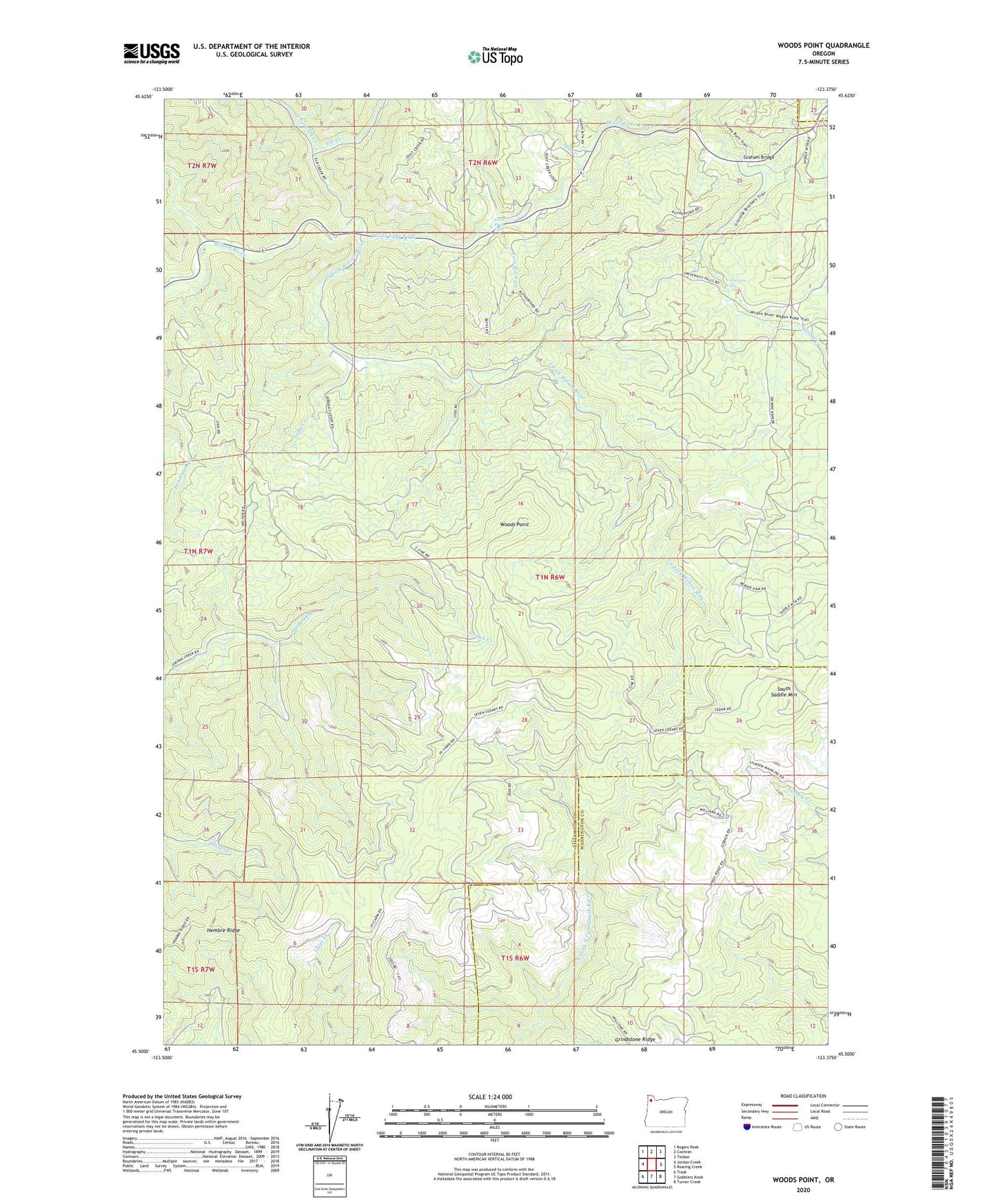
2024 topographic map quadrangle Woods Point in the state of Oregon. Scale: 1:24000. Based on the newly updated USGS 7.5' US Topo map series, this map is in the following counties: Tillamook, Washington. The map contains contour data, water features, and other items you are used to seeing on USGS maps, but also has updated roads and other features. This is the next generation of topographic maps. Printed on high-quality waterproof paper with UV fade-resistant inks.
Quads adjacent to this one:
West: Jordan Creek
Northwest: Rogers Peak
North: Cochran
Northeast: Timber
East: Roaring Creek
Southeast: Turner Creek
South: Gobblers Knob
Southwest: Trask
This map covers the same area as the classic USGS quad with code o45123e4.
Contains the following named places: Devils Lake Fork, Drift Creek, Elk Creek, Elk Creek Campground, Elliott Creek, Fern Rock Creek, Fern Rock Falls, Fern Rock Rest Area, Graham Bridge, Grindstone Ridge, Idiot Creek, Idiotville, Lyda Camp OHV Staging Area, McNamers Camp, Rogers Forest Park, South Fork Camp, South Fork Forest Camp Department of Corrections, South Fork Wilson River, Stagecoach Horsecamp, Timbuktu, Tuffy Creek, University Falls, West Fork Elk Creek, Woods Point