MyTopo
Wanderers Peak Oregon US Topo Map
Couldn't load pickup availability
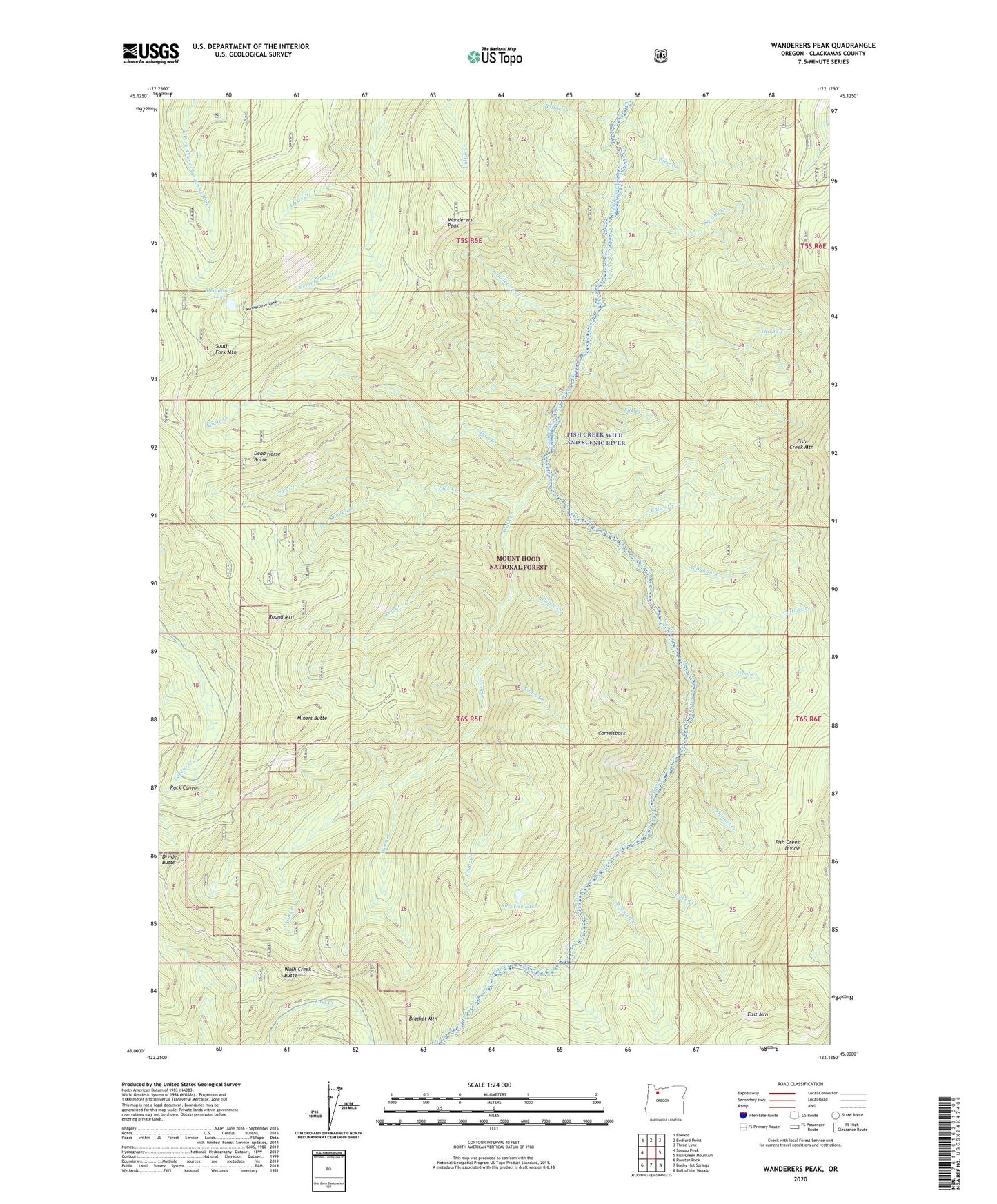
2020 topographic map quadrangle Wanderers Peak in the state of Oregon. Scale: 1:24000. Based on the newly updated USGS 7.5' US Topo map series, this map is in the following counties: Clackamas. The map contains contour data, water features, and other items you are used to seeing on USGS maps, but also has updated roads and other features. This is the next generation of topographic maps. Printed on high-quality waterproof paper with UV fade-resistant inks.
Quads adjacent to this one:
West: Soosap Peak
Northwest: Elwood
North: Bedford Point
Northeast: Three Lynx
East: Fish Creek Mountain
Southeast: Bull of the Woods
South: Bagby Hot Springs
Southwest: Rooster Rock
Contains the following named places: Big Meadow Quarry, Bracket Mountain, Bracket Mountain Quarry, Button Creek, Calico Creek, Calico Quarry, Camelsback, Cedar Creek, Coffee Creek, Cotton Creek, Dead Horse Butte, Deadhorse Quarry, Divide Butte, Dunharrow Quarry, East Mountain, Fall Creek, First Creek, Fish Creek Divide, Fish Creek Mountain, Fish Creek Saddle Quarry, Fish Creek Wild and Scenic River, Flannel Creek, Gingham Creek, Lunch Creek, Memaloose Lake, Miners Butte, Music Creek, Oasis Creek, Pick Creek, Round Mountain, Second Creek, Shovel Creek, Silk Creek, South Fork Mountain, Surprise Lake, Third Creek, Trout Creek Quarry, Tweed Creek, Wanderers Creek, Wanderers Peak, Wash Creek, Wash Creek Butte, Wear Creek, Whalehead Quarry, Wool Creek, Worsted Creek