MyTopo
Wasco Oregon US Topo Map
Couldn't load pickup availability
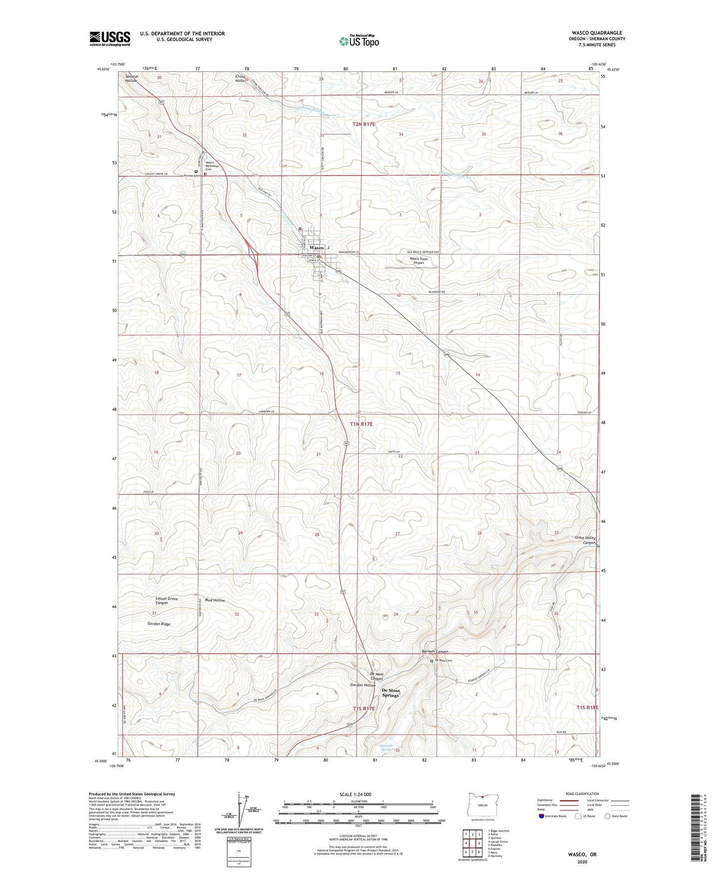
2020 topographic map quadrangle Wasco in the state of Oregon. Scale: 1:24000. Based on the newly updated USGS 7.5' US Topo map series, this map is in the following counties: Sherman. The map contains contour data, water features, and other items you are used to seeing on USGS maps, but also has updated roads and other features. This is the next generation of topographic maps. Printed on high-quality waterproof paper with UV fade-resistant inks.
Quads adjacent to this one:
West: Locust Grove
Northwest: Biggs Junction
North: Rufus
Northeast: Quinton
East: Klondike
Southeast: Harmony
South: Moro
Southwest: Erskine
Contains the following named places: Badger Post Office, Barnum Canyon, City of Wasco, De Moss, De Moss Canyon, De Moss Cemetery, De Moss County Park, De Moss Springs, De Moss Springs Post Office, Gordon Hollow, Kenneth Spring, North Sherman County Rural Fire Protection District, North Sherman Elementary School, Sink, Spanish Hollow, Sunrise Cemetery, Wasco, Wasco City / Community Library, Wasco City Hall, Wasco City Park, Wasco Depot Park, Wasco Division, Wasco Methodist Cemetery, Wasco Post Office, Wasco Public Works, Wasco Sewage Lagoon, Wasco State Airport, ZIP Code: 97065