MyTopo
Whistler Point Oregon US Topo Map
Couldn't load pickup availability
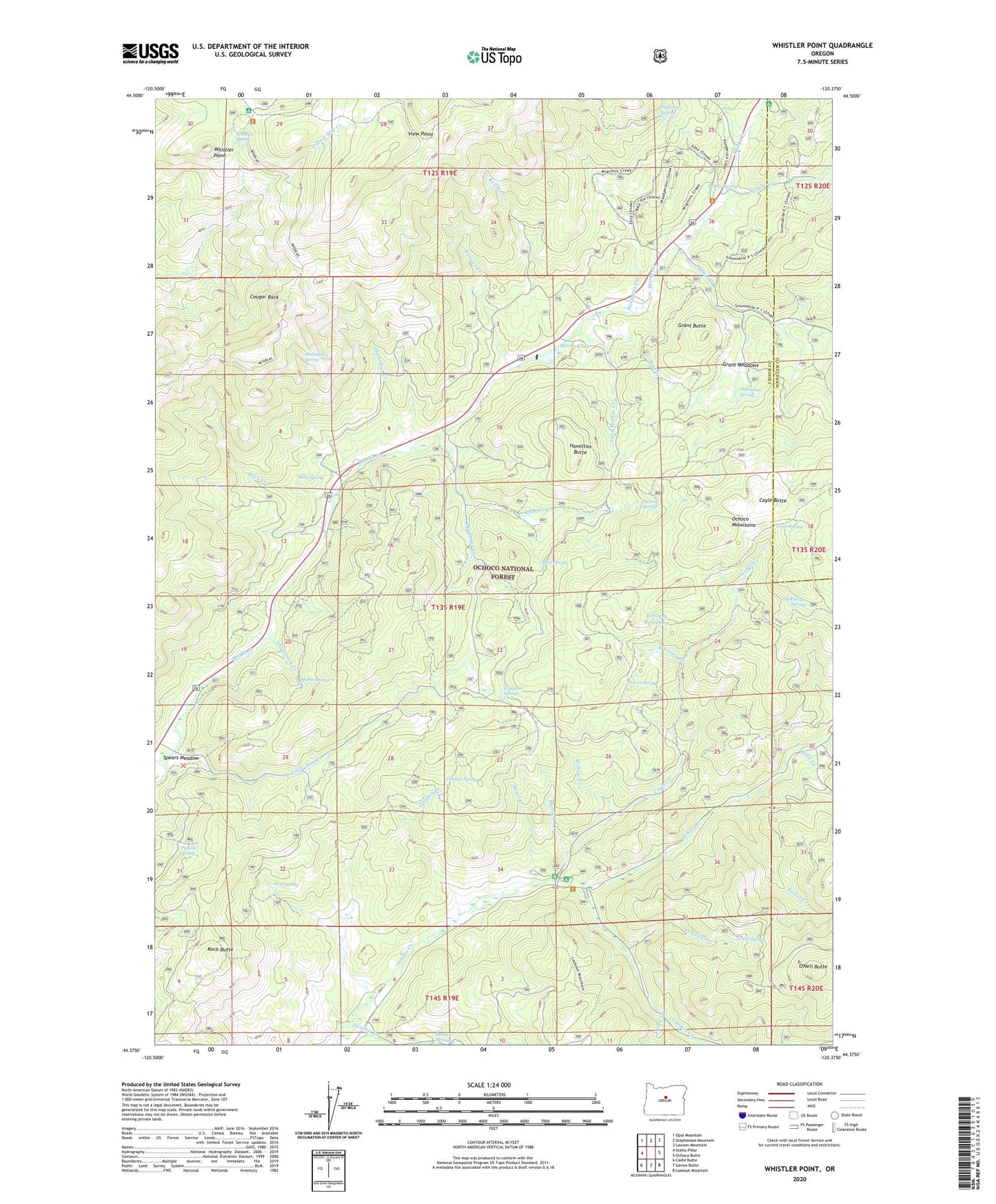
2020 topographic map quadrangle Whistler Point in the state of Oregon. Scale: 1:24000. Based on the newly updated USGS 7.5' US Topo map series, this map is in the following counties: Crook, Wheeler. The map contains contour data, water features, and other items you are used to seeing on USGS maps, but also has updated roads and other features. This is the next generation of topographic maps. Printed on high-quality waterproof paper with UV fade-resistant inks.
Quads adjacent to this one:
West: Steins Pillar
Northwest: Opal Mountain
North: Stephenson Mountain
Northeast: Lawson Mountain
East: Ochoco Butte
Southeast: Lookout Mountain
South: Gerow Butte
Southwest: Cadle Butte
Contains the following named places: Bandit Spring, Bandit Spring Safety Rest Area, Buck Creek, Buck Spring, Canyon Creek, Claypool Spring, Cornez Creek, Cougar Forest Camp, Cougar Rock, Cox Reservoir, Coyle Butte, Coyle Creek, Coyle Spring, Crystal Creek, Deadman Creek, Douthit Creek, Downs Spring, Fisher Creek, Garden Creek, Garden Spring, Grant Butte, Grant Meadows, Halfway Spring, Hamilton Butte, Hamilton Creek, Hamilton Spring, Hon Spring, Judy Creek, Koch Butte, Koch Reservoir, Little Hay Creek, Long Hollow Creek, Mahogany Spring, Marks Creek Lodge, Marks Lake, Marks Lake Dam, Marks Spring, McGinnis Creek, Mercury Creek, Metal Creek, Mount Bachelor Academy, Nature Creek, Ochoco Divide Research Area, Ochoco Mountains, Ochoco Recreation Site, O'Neil Butte, O'Neil Creek, O'Neil Spring, Pothole Spring, Rail Creek, Reilly Creek, Rush Creek, Rush Spring, Scissors Creek, Section Eight Reservoir, Shamrock Creek, Spears Meadow, Stewart Spring, Thorn Creek, View Point, Whistler Point, Whistler Recreation Site, Whistler Spring, Whitney Creek, Whitney Reservoir, Wickheiser Spring, Wildcat Creek, Willow Creek