MyTopo
Whiteline Reservoir Oregon US Topo Map
Couldn't load pickup availability
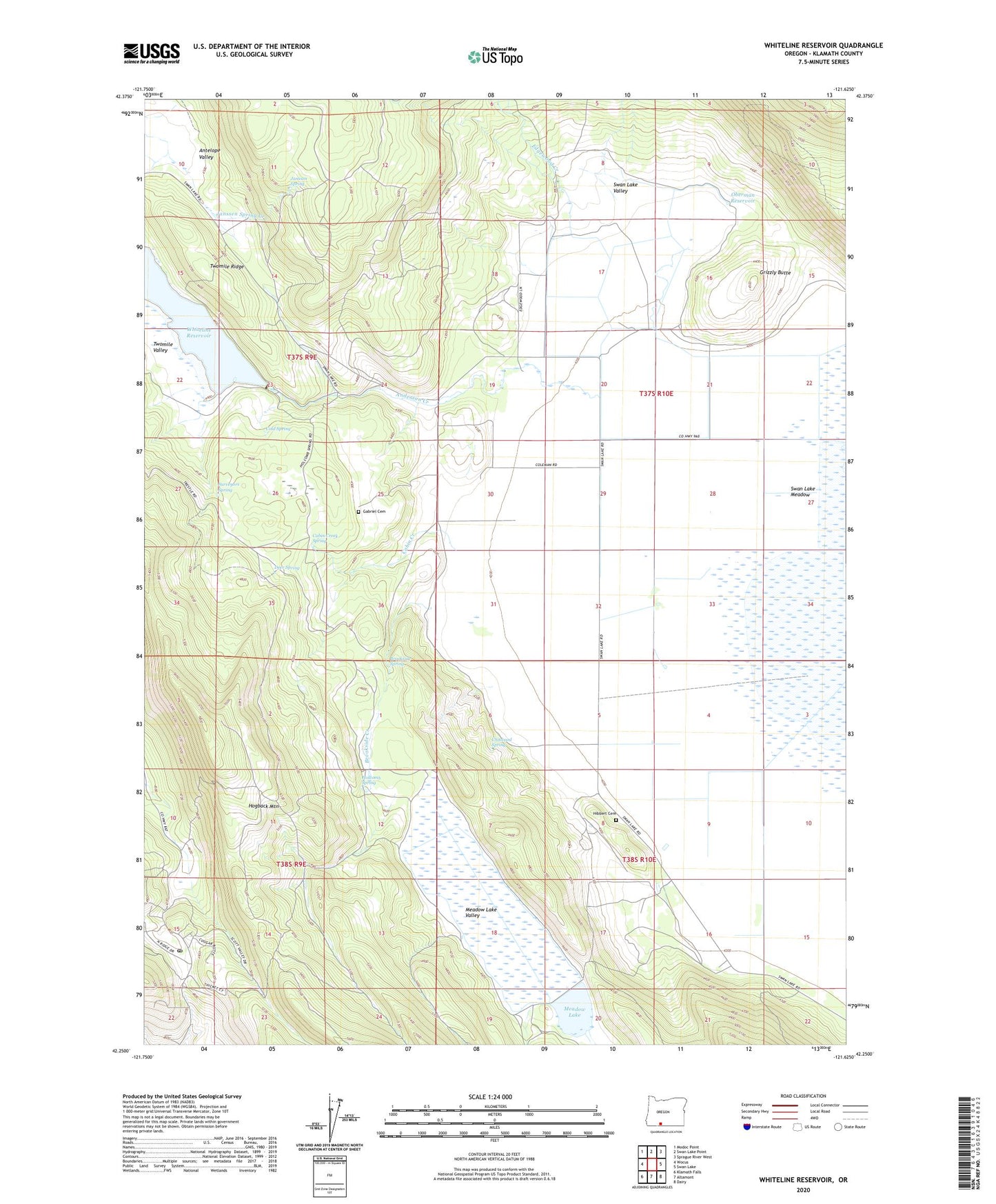
2020 topographic map quadrangle Whiteline Reservoir in the state of Oregon. Scale: 1:24000. Based on the newly updated USGS 7.5' US Topo map series, this map is in the following counties: Klamath. The map contains contour data, water features, and other items you are used to seeing on USGS maps, but also has updated roads and other features. This is the next generation of topographic maps. Printed on high-quality waterproof paper with UV fade-resistant inks.
Quads adjacent to this one:
West: Wocus
Northwest: Modoc Point
North: Swan Lake Point
Northeast: Sprague River West
East: Swan Lake
Southeast: Dairy
South: Altamont
Southwest: Klamath Falls
Contains the following named places: Anderson Creek, Antelope Valley, Brookside Creek, Brookside Spring, Cabin Creek, Cabin Creek Spring, Chitwood Spring, Cold Spring, Coleman Ranch, Deer Spring, Edgewood Creek, Edgewood Ranch, Gabriel Cemetery, Grizzly Butte, Hibbert Cemetery, Holcomb Spring, Janssen Ranch, Janssen Spring, Janssen Spring Creek, Meadow Lake, Meadow Lake Dam, Meadow Lake Valley, Oberman Reservoir, Oregon Technical Institute, Oretech Post Office, Surveyors Spring, Swan, Swan Lake Meadow, Swan Post Office, Twomile Ridge, Twomile Valley, Whiteline Dam, Whiteline Ditch, Whiteline Reservoir