MyTopo
Modoc Point Oregon US Topo Map
Couldn't load pickup availability
Also explore the Modoc Point Forest Service Topo of this same quad for updated USFS data
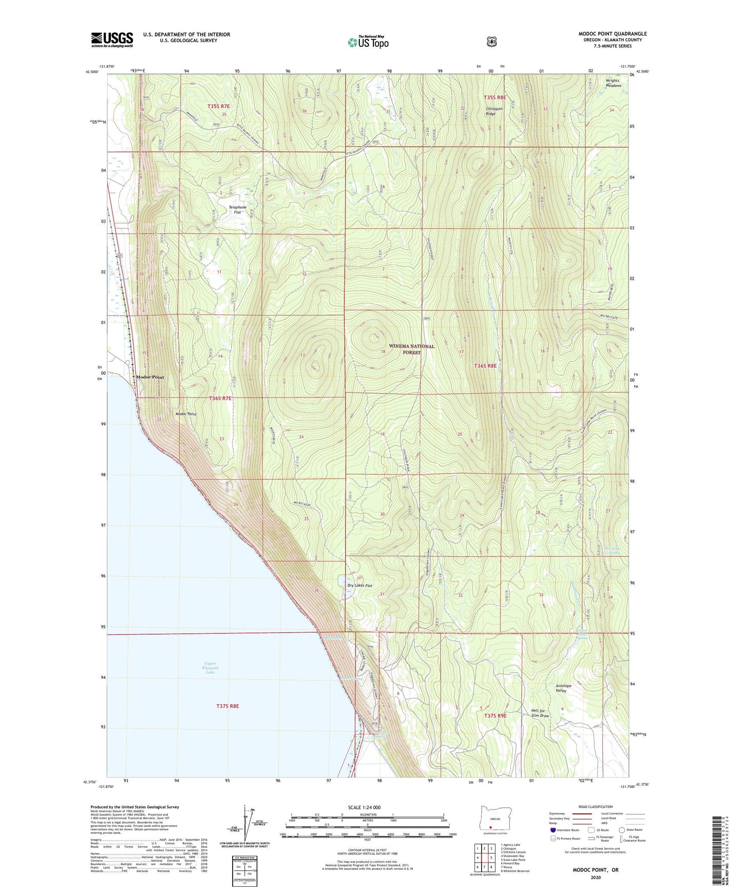
2023 topographic map quadrangle Modoc Point in the state of Oregon. Scale: 1:24000. Based on the newly updated USGS 7.5' US Topo map series, this map is in the following counties: Klamath. The map contains contour data, water features, and other items you are used to seeing on USGS maps, but also has updated roads and other features. This is the next generation of topographic maps. Printed on high-quality waterproof paper with UV fade-resistant inks.
Quads adjacent to this one:
West: Shoalwater Bay
Northwest: Agency Lake
North: Chiloquin
East: Swan Lake Point
Southeast: Whiteline Reservoir
South: Wocus
Southwest: Howard Bay
This map covers the same area as the classic USGS quad with code o42121d7.
Contains the following named places: Barkley, Barkley Spring, Canby Mountains, Dry Lakes Flat, Hagelstein County Park, Hagelstein Park Boat Ramp, Harriman Lodge, Hell for Slim Draw, Modoc Point, Modoc Point Post Office, Ouxy, Ouxy Spring, Shell Rock Spring, Sucker Spring, Telephone Flat, Yellow Jacket Spring