MyTopo
Wolf Peak Oregon US Topo Map
Couldn't load pickup availability
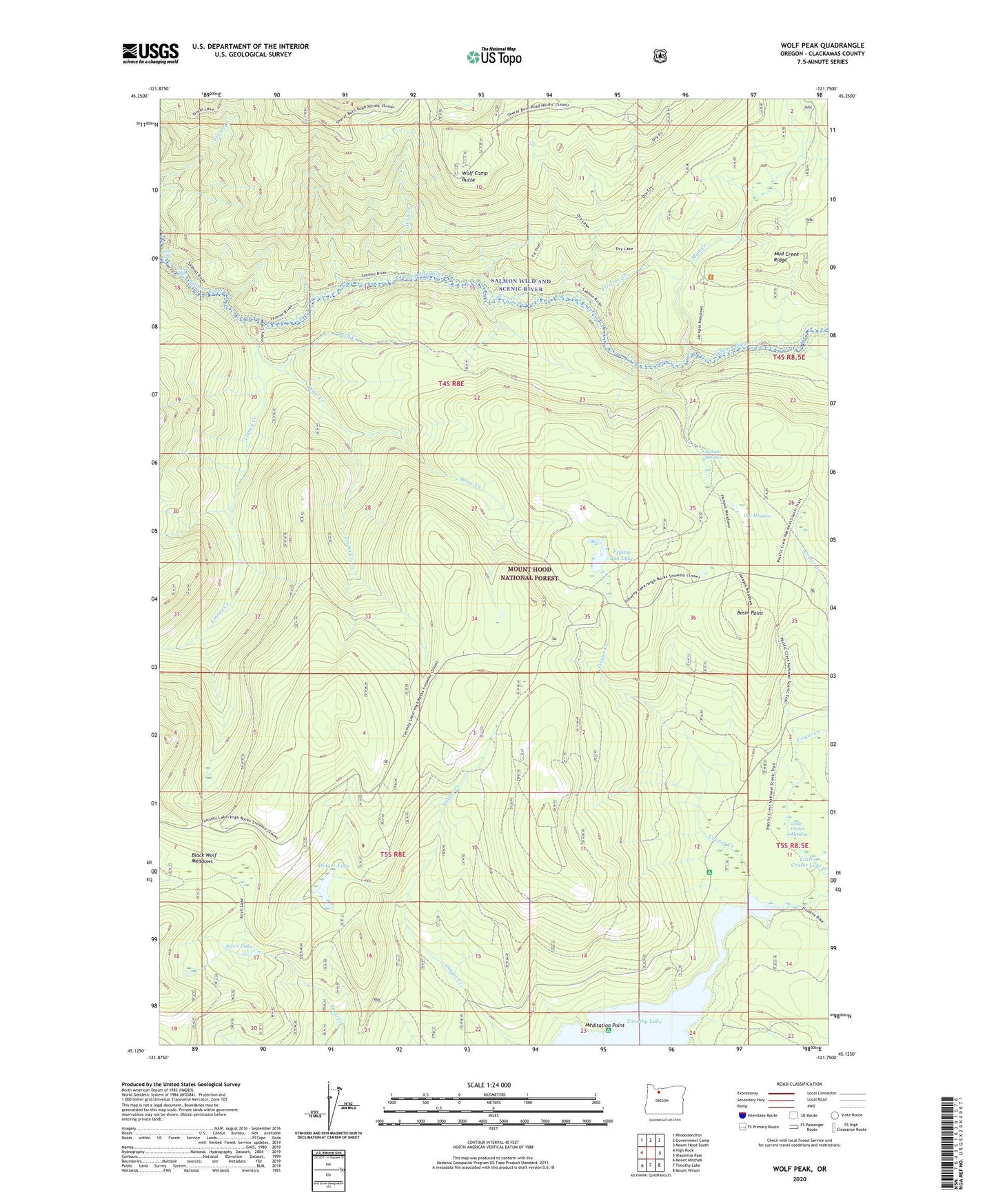
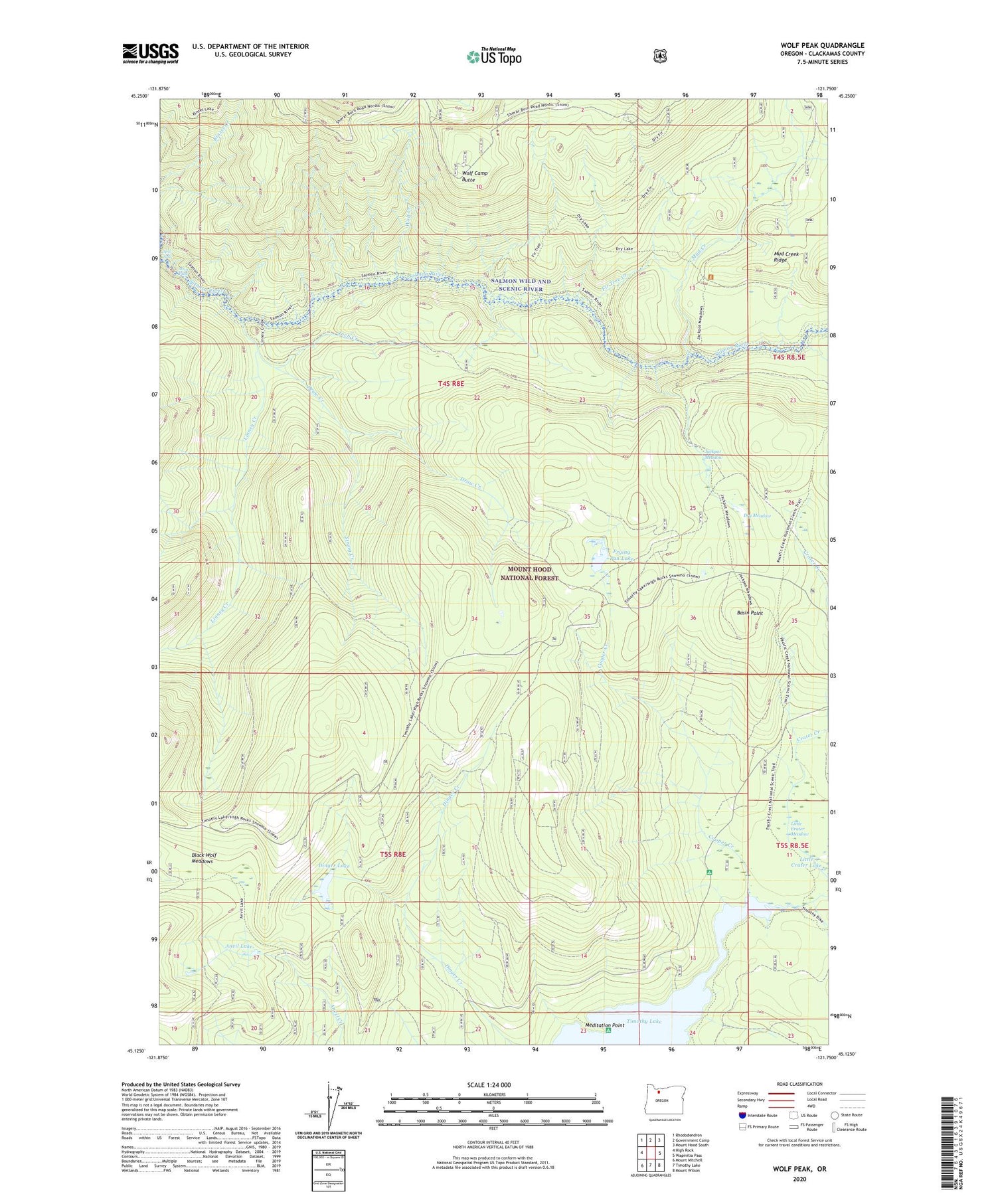
2020 topographic map quadrangle Wolf Peak in the state of Oregon. Scale: 1:24000. Based on the newly updated USGS 7.5' US Topo map series, this map is in the following counties: Clackamas. The map contains contour data, water features, and other items you are used to seeing on USGS maps, but also has updated roads and other features. This is the next generation of topographic maps. Printed on high-quality waterproof paper with UV fade-resistant inks.
Quads adjacent to this one:
West: High Rock
Northwest: Rhododendron
North: Government Camp
Northeast: Mount Hood South
East: Wapinitia Pass
Southeast: Mount Wilson
South: Timothy Lake
Southwest: Mount Mitchell
Contains the following named places: Abbott Burn, Anvil Lake, Basin Point, Basin Point Quarry, Black Wolf Meadows, Buck Creek Trail, Buck Lake Gravel Pit, Cooper Creek, Crater Creek, Dinger Creek Trail, Dinger Lake, Draw Creek, Dry Meadow, Fir Tree Campground, Fir Tree Creek, Frying Pan Lake, Frying Pan Quarry, Inch Creek, Jackpot Meadow, Linney Creek, Linney Creek Recreation Site, Little Crater Lake, Little Crater Lake Geological Area, Meditation Point, Meditation Point Recreation Site, Mud Creek, North Arm Recreation Site, Sherar Burn, Split Falls, Stein Falls, String Creek, Wolf Camp Butte, Wolf Creek, Wolf Peak