MyTopo
Wren Oregon US Topo Map
Couldn't load pickup availability
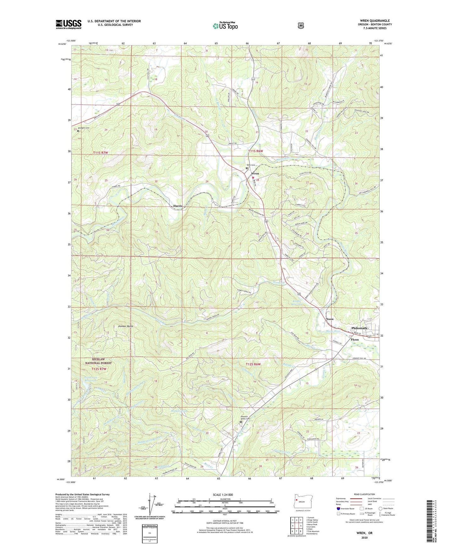
2020 topographic map quadrangle Wren in the state of Oregon. Scale: 1:24000. Based on the newly updated USGS 7.5' US Topo map series, this map is in the following counties: Benton. The map contains contour data, water features, and other items you are used to seeing on USGS maps, but also has updated roads and other features. This is the next generation of topographic maps. Printed on high-quality waterproof paper with UV fade-resistant inks.
Quads adjacent to this one:
West: Marys Peak
Northwest: Summit
North: Kings Valley
Northeast: Airlie South
East: Corvallis
Southeast: Greenberry
South: Flat Mountain
Southwest: Alsea
Contains the following named places: Ahmoolint Creek, Ahngeengeen Creek, Ahnhoots Creek, Ahntkwahkwah Creek, Ahshahyum Creek, Blair Creek, Blakesley Creek, Blodgett Cemetery, Bounds Creek, Connection Creek, Corvallis Rock Creek Water Treatment Plant, Enos Creek, Flynn, Garrow, Gellatly Creek, Gray Creek, Greasy Creek, Griffith Creek, Harris, Harris Post Office, Knight Reservoir, La Bare Creek, Marys River Grange, Middle Fork Rock Creek, Miller Creek, Noon, North Fork Dam, North Fork Reservoir, North Fork Rock Creek, Philomath Fire and Rescue Station 202, Pioneer Butte, Pleasant Valley Cemetery, Read Creek, Rock Creek, Rock Creek City Park, Russell, South Fork Rock Creek, Stilson Creek, Tatum Creek, Watkins Creek, Watkins Pond, Woods Creek, Wren, Wren Cemetery, Wren Forest Service Station, Wren Guard Station, Wren Post Office, ZIP Code: 97370