MyTopo
Kings Valley Oregon US Topo Map
Couldn't load pickup availability
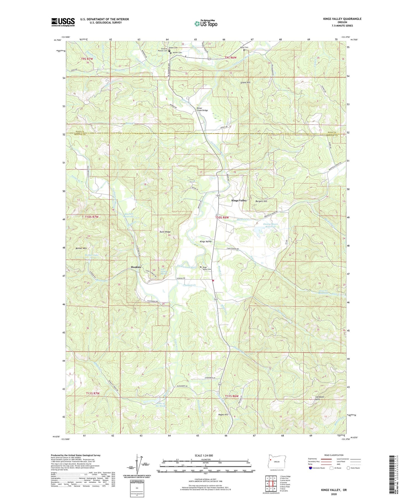
2023 topographic map quadrangle Kings Valley in the state of Oregon. Scale: 1:24000. Based on the newly updated USGS 7.5' US Topo map series, this map is in the following counties: Benton, Polk. The map contains contour data, water features, and other items you are used to seeing on USGS maps, but also has updated roads and other features. This is the next generation of topographic maps. Printed on high-quality waterproof paper with UV fade-resistant inks.
Quads adjacent to this one:
West: Summit
Northwest: Fanno Ridge
North: Falls City
Northeast: Airlie North
East: Airlie South
Southeast: Corvallis
South: Wren
Southwest: Marys Peak
This map covers the same area as the classic USGS quad with code o44123f4.
Contains the following named places: Alexander Creek, Alexander School, Beazell Memorial County Forest, Bonner Creek, Bonner Lake, Bonner Mountain, Bump Creek, Burgett Creek, Burgett Hill, Clayton Creek, Dunn Ridge, Edwards Pioneer Cemetery, Emory Moore Dam, Emory Moore Reservoir, Fort Hoskins Historic County Park, Fort Hoskins Spring, Foster Creek, Four Points, Grant Hill, Hayes Hill, Hoskins, Hoskins - Kings Valley Rural Fire Protection District, Hoskins Post Office, Isaac King Family Cemetery, Jones Creek, Keas Corner, Kings Valley, Kings Valley Cemetery, Kings Valley Census Designated Place, Kings Valley Charter School, Kings Valley Post Office, Kinsey Creek, Kopplein, Lake of the Winds, Love Creek, Luckiamute Valley Charter School, Maxfield Creek, Mitchell Reservoir, Moody School, North Benton Division, Pedee Cemetery, Pedee Creek, Pedee School, Plunkett Creek, Price Creek, Price Creek Reservoir, Ring Orchard, Ritner, Ritner Creek, Ritner Creek Bridge, Ritner Creek County Park, Sheythe Creek, Simpsons Camp, Taylor Cemetery, Tiff, Vincent Creek, Ward School, Watson Creek, Whispering Winds Dam, Womer Cemetery, Woods Creek