MyTopo
Greenberry Oregon US Topo Map
Couldn't load pickup availability
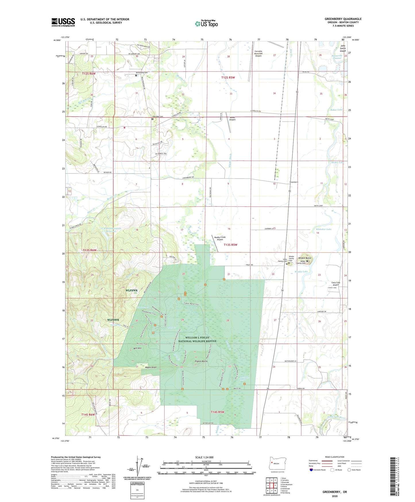
2023 topographic map quadrangle Greenberry in the state of Oregon. Scale: 1:24000. Based on the newly updated USGS 7.5' US Topo map series, this map is in the following counties: Benton. The map contains contour data, water features, and other items you are used to seeing on USGS maps, but also has updated roads and other features. This is the next generation of topographic maps. Printed on high-quality waterproof paper with UV fade-resistant inks.
Quads adjacent to this one:
West: Flat Mountain
Northwest: Wren
North: Corvallis
Northeast: Riverside
East: Peoria
Southeast: Harrisburg
South: Monroe
Southwest: Glenbrook
This map covers the same area as the classic USGS quad with code o44123d3.
Contains the following named places: Armstrong Cemetery, Baker Lake, Barclay, Beaver Creek, Booneville, Brown Creek, Bruce, Bruce Post Office, Buchanan, Bull Run Creek, Buttes, Cabell Marsh, Coca Cola Airport, Corvallis Army Air Field, Fern Post Office, Gray Creek, Greenberry, Henderson Family Cemetery, Herbert Family Cemetery, Hughes, Hull Creek, Hull Spring, Inavale Post Office, Irwin Family Cemetery, Jennyopolis Post Office, Maple Knoll, McBee Family Cemetery, McBee Lake, McFadden Marsh, Mill Hill, Muddy Creek Airport, Muddy Creek Charter School, Oakridge Cemetery, Oscar Dow Burial Site, P M Delaubenfelds Dam, P M Delaubenfelds Reservoir, Philomath Fire and Rescue Station 203, Pigeon Butte, Reckards, Rickard, Rickard Post Office, Saxton County Park, Shrock, Southeast Benton Division, Starr Creek, Statesman Post Office, Venell Airport, Whitaker Lake, Whitby Ditch, William L Finley National Wildlife Refuge, Winfield, Winkle Butte, Winkle Family Cemetery, Winkle Lake, ZIP Code: 97333