MyTopo
Yamsay Mountain Oregon US Topo Map
Couldn't load pickup availability
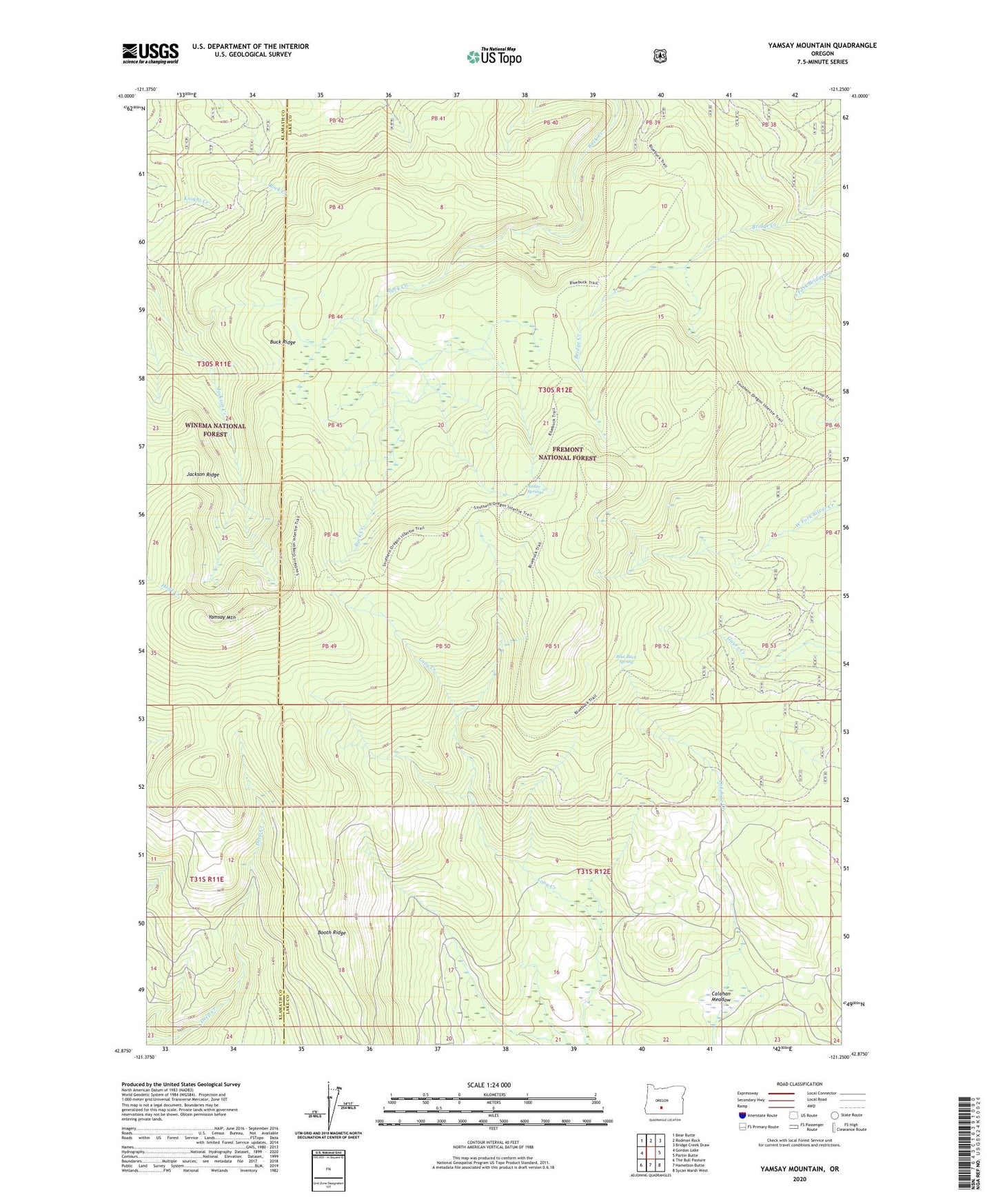
2020 topographic map quadrangle Yamsay Mountain in the state of Oregon. Scale: 1:24000. Based on the newly updated USGS 7.5' US Topo map series, this map is in the following counties: Lake, Klamath. The map contains contour data, water features, and other items you are used to seeing on USGS maps, but also has updated roads and other features. This is the next generation of topographic maps. Printed on high-quality waterproof paper with UV fade-resistant inks.
Quads adjacent to this one:
West: Gordon Lake
Northwest: Bear Butte
North: Rodman Rock
Northeast: Bridge Creek Draw
East: Partin Butte
Southeast: Sycan Marsh West
South: Hamelton Butte
Southwest: The Bull Pasture
Contains the following named places: Antler Springs, Blue Buck Camp, Blue Buck Spring, Booth Ridge, Buck Ridge, Calahan Meadow, Jackson Ridge, Yamsay Mountain