MyTopo
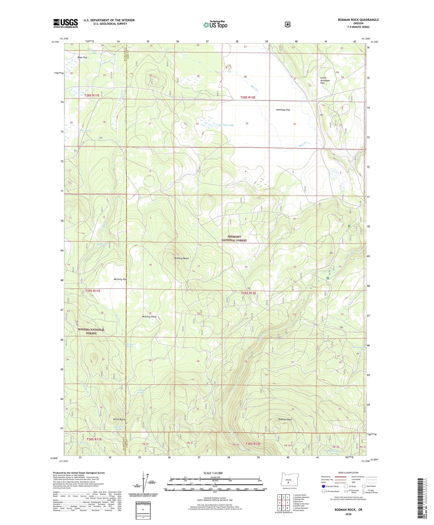
Rodman Rock Oregon US Topo Map
Couldn't load pickup availability
Also explore the Rodman Rock Forest Service Topo of this same quad for updated USFS data
2024 topographic map quadrangle Rodman Rock in the state of Oregon. Scale: 1:24000. Based on the newly updated USGS 7.5' US Topo map series, this map is in the following counties: Lake, Klamath. The map contains contour data, water features, and other items you are used to seeing on USGS maps, but also has updated roads and other features. This is the next generation of topographic maps. Printed on high-quality waterproof paper with UV fade-resistant inks.
Quads adjacent to this one:
West: Bear Butte
Northwest: Location Butte
North: Antelope Mountain
Northeast: Oatman Flat
East: Bridge Creek Draw
Southeast: Partin Butte
South: Yamsay Mountain
Southwest: Gordon Lake
This map covers the same area as the classic USGS quad with code o43121a3.
Contains the following named places: Antelope Cow Camp, Antelope Flat, Antelope Lake, Antelope Well, Bear Flat Station, Bear Spring, Boundary Spring, Camp Fourteen, Coffeepot Spring, Dillon Butte, Little Antelope Flat, McCarty Butte, McCarty Field, McCarty Flat, McKinley Ranch, Peterson Cabin, Road Spring, Rock Creek, Rodman Rock, Section One Spring, Shanahan Place, Still Spring, Trapper Spring, Upper Buck Creek Recreation Site