MyTopo
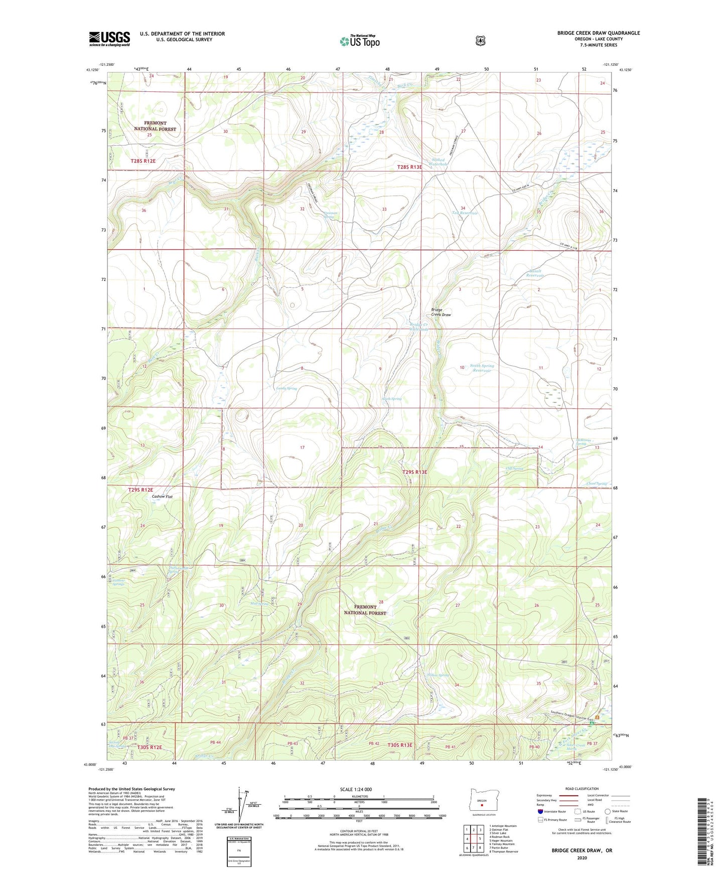
Bridge Creek Draw Oregon US Topo Map
Couldn't load pickup availability
Also explore the Bridge Creek Draw Forest Service Topo of this same quad for updated USFS data
2023 topographic map quadrangle Bridge Creek Draw in the state of Oregon. Scale: 1:24000. Based on the newly updated USGS 7.5' US Topo map series, this map is in the following counties: Lake. The map contains contour data, water features, and other items you are used to seeing on USGS maps, but also has updated roads and other features. This is the next generation of topographic maps. Printed on high-quality waterproof paper with UV fade-resistant inks.
Quads adjacent to this one:
West: Rodman Rock
Northwest: Antelope Mountain
North: Oatman Flat
Northeast: Silver Lake
East: Hager Mountain
Southeast: Thompson Reservoir
South: Partin Butte
Southwest: Yamsay Mountain
This map covers the same area as the classic USGS quad with code o43121a2.
Contains the following named places: Basalt Reservoir, Bear Creek, Brewer Ranch, Bridge Creek Draw, Bridge Creek Waterhole, Buck Creek Crossing, Cashow Flat, Cashow Springs, Chase Spring, Cliff Spring, D Emery Ranch, Freeman Ranch, Freeman Spring, Howard Ranch, Lower Buck Creek Recreation Site, Lundy Spring, McBroom Administrative Study Plot, McBroom Ranch, McBroom Spring, Mud Spring, Pitcher Ranch, Porterville Post Office, Silver Creek Marsh, Silver Creek Marsh Recreation Site, South Spring, South Spring Reservoir, Staked Waterhole, Ted Reservoir, Thirteenmile Spring, Timothy Creek, Willow Spring