MyTopo
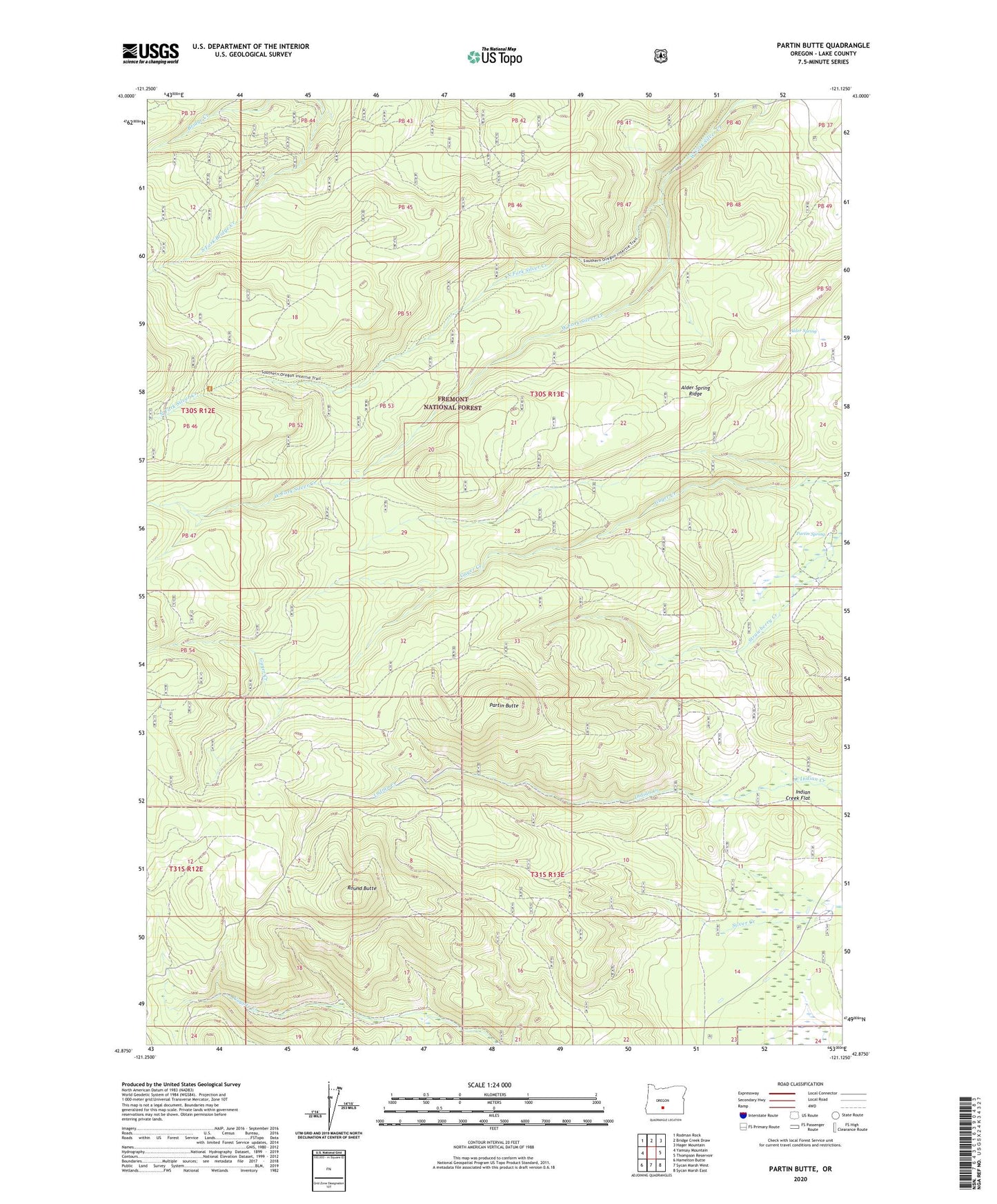
Partin Butte Oregon US Topo Map
Couldn't load pickup availability
Also explore the Partin Butte Forest Service Topo of this same quad for updated USFS data
2023 topographic map quadrangle Partin Butte in the state of Oregon. Scale: 1:24000. Based on the newly updated USGS 7.5' US Topo map series, this map is in the following counties: Lake. The map contains contour data, water features, and other items you are used to seeing on USGS maps, but also has updated roads and other features. This is the next generation of topographic maps. Printed on high-quality waterproof paper with UV fade-resistant inks.
Quads adjacent to this one:
West: Yamsay Mountain
Northwest: Rodman Rock
North: Bridge Creek Draw
Northeast: Hager Mountain
East: Thompson Reservoir
Southeast: Sycan Marsh East
South: Sycan Marsh West
Southwest: Hamelton Butte
This map covers the same area as the classic USGS quad with code o42121h2.
Contains the following named places: Alder Spring, Alder Spring Recreation Site, Alder Spring Ridge, Antler Trailhead, Elder Cabin, Indian Creek Flat, North Fork Silver Creek, Partin Butte, Partin Spring, Round Butte